Saint Ann’s Bay night lights from space
Night Light of Saint Ann’s Bay (St Ann) from space (Jamaica) Src. Average luminocity for 10x10km area is 20.7335% and for 50x50km: 4.2355%.
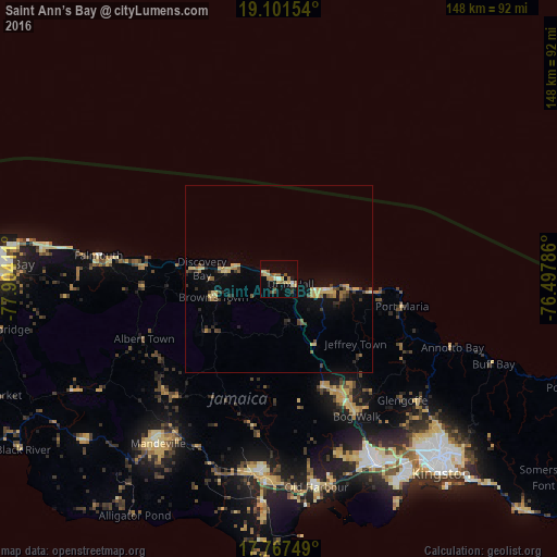
Analysis of Saint Ann’s Bay night lights 2016
Square area 10x10 km:
 0%
0%90-99
1.86%80-89
6.61%70-79
3.1%60-69
2.27%50-59
4.75%40-49
4.55%30-39
0%20-29
1.65%10-19
6.2%0-9
69.01%Square area 50x50 km:
0.02%90-99
0.12%80-89
1.23%70-79
0.51%60-69
0.51%50-59
0.55%40-49
0.86%30-39
0.66%20-29
0.64%10-19
1.9%0-9
92.99%Clear (daylight) street map image can be seen on geolist.org.
Map coordinates:
19° 6' 5.5" North, 77° 54' 14.8" West
18° 26' 8.9" North, 77° 12' 3.5" West
17° 46' 3" North, 76° 29' 52.3" West
Some cities around Saint Ann’s Bay sort by population:
• Linstead
37.7 km =23.4 mi,  151°
151°
• Bog Walk
42.5 km =26.4 mi, 150°
• Ewarton
30.6 km =19 mi,  156°
156°
• Ocho Rios
10.8 km =6.7 mi,  106°
106°
• Port Maria
33.7 km =20.9 mi,  102°
102°
• Falmouth
48.4 km =30.1 mi,  277°
277°
• Runaway Bay
14.5 km =9 mi, 280°
• Point Hill
39.7 km =24.7 mi,  165°
165°
3488713 (p: 13,671)
Sources (retrieved 2019-11-25):
» Earth at Night: Flat Maps 2012, 2016