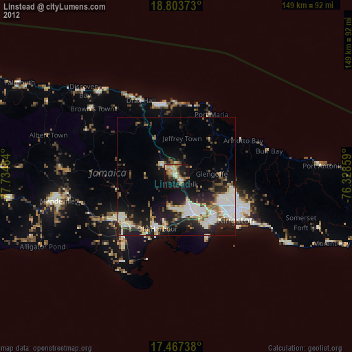
Linstead night lights from space
Night Light of Linstead (Saint Catherine) from space (Jamaica) Src. Average luminocity for 10x10km area is 41.381% and for 50x50km: 18.4482%.
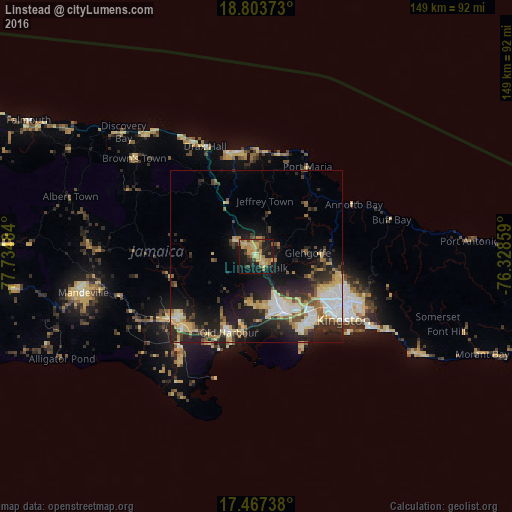
Analysis of Linstead night lights 2016
Square area 10x10 km:
 0%
0%90-99
0.87%80-89
14.72%70-79
12.12%60-69
7.79%50-59
4.98%40-49
8.44%30-39
1.52%20-29
7.14%10-19
36.15%0-9
6.28%Square area 50x50 km:
2.54%90-99
2.42%80-89
4.04%70-79
2.25%60-69
1.88%50-59
1.89%40-49
2.59%30-39
2.82%20-29
6%10-19
12.49%0-9
61.08%Clear (daylight) street map image can be seen on geolist.org.
Map coordinates:
18° 48' 13.4" North, 77° 44' 5.4" West
18° 8' 12.6" North, 77° 1' 54.2" West
17° 28' 2.6" North, 76° 19' 42.9" West
Some cities around Linstead sort by population:
• Spanish Town
18 km =11.2 mi,  154°
154°
• Portmore
26.1 km =16.2 mi,  142°
142°
• Old Harbour
23.2 km =14.4 mi,  200°
200°
• Bog Walk
4.8 km =3 mi, 144°
• Ewarton
7.7 km =4.8 mi,  312°
312°
• Stony Hill
26.9 km =16.7 mi,  103°
103°
• Old Harbour Bay
26.2 km =16.3 mi, 195°
• Point Hill
9.6 km =6 mi,  236°
236°
3489760 (p: 20,660)
Sources (retrieved 2019-11-25):
» Earth at Night: Flat Maps 2012, 2016