Trenzano night lights from space
Night Light of Trenzano (Lombardy) from space (Italy) Src. Average luminocity for 10x10km area is 41.054% and for 50x50km: 42.7709%.
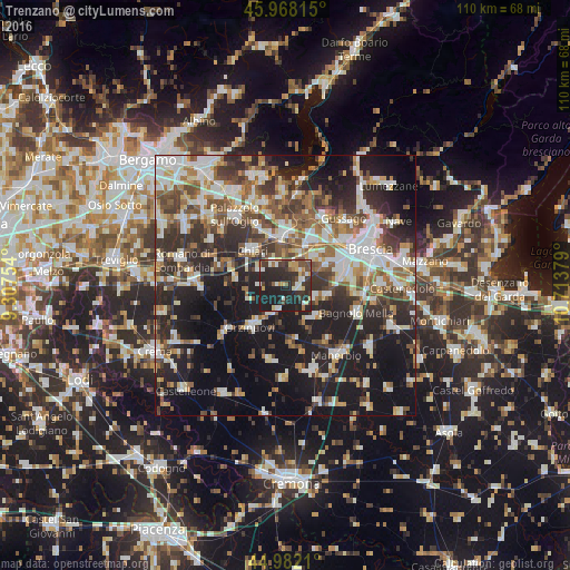
Analysis of Trenzano night lights 2016
Square area 10x10 km:
 4.13%
4.13%90-99
8.25%80-89
4.29%70-79
5.24%60-69
2.06%50-59
5.08%40-49
6.51%30-39
9.84%20-29
31.11%10-19
23.49%0-9
0%Square area 50x50 km:
7.87%90-99
9.14%80-89
3.97%70-79
3.93%60-69
5.53%50-59
6.64%40-49
6.24%30-39
7.49%20-29
12.83%10-19
23.25%0-9
13.11%Clear (daylight) street map image can be seen on geolist.org.
Map coordinates:
45° 58' 5.3" North, 9° 18' 27.1" East
45° 28' 38.2" North, 10° 0' 38.4" East
44° 58' 55.6" North, 10° 42' 49.6" East
Some cities around Trenzano sort by population:
• Chiari
9.4 km =5.8 mi,  315°
315°
• Ospitaletto
9.7 km =6 mi,  31°
31°
• Travagliato
7.5 km =4.7 mi,  46°
46°
• Rovato
9.6 km =6 mi,  356°
356°
• Castrezzato
4.4 km =2.7 mi,  328°
328°
• Castelcovati
5.7 km =3.5 mi,  298°
298°
• Torbole Casaglia
9.2 km =5.7 mi,  64°
64°
• Rudiano
9.8 km =6.1 mi,  277°
277°
6535205 (p: 5,189)
Sources (retrieved 2019-11-25):
» Earth at Night: Flat Maps 2012, 2016