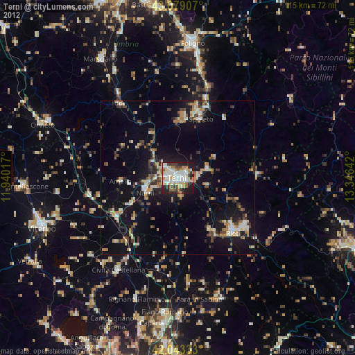
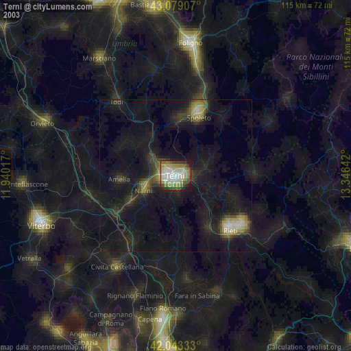
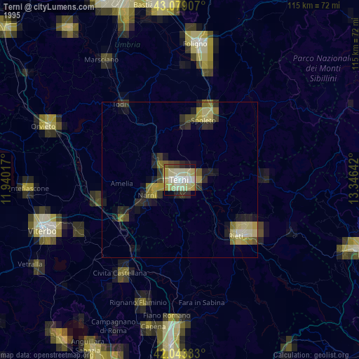
Terni night lights from space
Night Light of Terni (Umbria) from space (Italy) Src. Average luminocity for 10x10km area is 60.4921% and for 50x50km: 11.7278%.

Analysis of Terni night lights 2016
Square area 10x10 km:
 16.98%
90-99
15.87%80-89
4.6%70-79
5.08%60-69
5.87%50-59
6.19%40-49
10.79%30-39
9.84%20-29
17.3%10-19
7.46%0-9
0%Square area 50x50 km:
1.27%90-99
1.89%80-89
1.05%70-79
0.94%60-69
1.39%50-59
1.46%40-49
2.04%30-39
2.05%20-29
3.64%10-19
9.64%0-9
74.63%Clear (daylight) street map image can be seen on geolist.org.
Map coordinates:
43° 4' 44.7" North, 11° 56' 24.6" East
42° 33' 48.1" North, 12° 38' 35.8" East
42° 2' 36" North, 13° 20' 47.1" East
Some cities around Terni sort by population:
• Rieti
24.9 km =15.5 mi,  135°
135°
• Spoleto
21.2 km =13.2 mi,  21°
21°
• Civita Castellana
35.7 km =22.2 mi,  212°
212°
• Todi
30.5 km =19 mi,  321°
321°
• Soriano nel Cimino
37.2 km =23.1 mi,  244°
244°
• Amelia
18.3 km =11.4 mi,  265°
265°
• Narni
10.7 km =6.6 mi, 242°
• Narni Scalo
10.8 km =6.7 mi,  253°
253°
3165771 (p: 97,050)
Sources (retrieved 2019-11-25):
» NASA, Earths city lights 1995
» NASA city lights 2003
» Earth at Night: Flat Maps 2012, 2016