Soleto night lights from space
Night Light of Soleto (Apulia) from space (Italy) Src. Average luminocity for 10x10km area is 48.6672% and for 50x50km: 31.7359%.
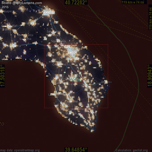
Analysis of Soleto night lights 2016
Square area 10x10 km:
 6.17%
6.17%90-99
9.42%80-89
4.71%70-79
9.58%60-69
6.17%50-59
4.38%40-49
5.03%30-39
12.99%20-29
36.53%10-19
5.03%0-9
0%Square area 50x50 km:
3.61%90-99
6.16%80-89
4.06%70-79
3.32%60-69
4.14%50-59
3.35%40-49
3.38%30-39
6.53%20-29
17.38%10-19
20.68%0-9
27.39%Clear (daylight) street map image can be seen on geolist.org.
Map coordinates:
40° 43' 22.2" North, 17° 30' 11.4" East
40° 11' 16.1" North, 18° 12' 22.7" East
39° 38' 54.7" North, 18° 54' 33.9" East
Some cities around Soleto sort by population:
• Galatina
3.4 km =2.1 mi,  243°
243°
• Maglie
10.8 km =6.7 mi,  133°
133°
• Aradeo
9.2 km =5.7 mi,  225°
225°
• Martano
8.3 km =5.2 mi,  78°
78°
• Cutrofiano
6.9 km =4.3 mi,  182°
182°
• Calimera
9.3 km =5.8 mi,  42°
42°
• Corigliano d'Otranto
5.3 km =3.3 mi, 126°
• Neviano
11.9 km =7.4 mi,  220°
220°
3166428 (p: 5,098)
Sources (retrieved 2019-11-25):
» Earth at Night: Flat Maps 2012, 2016