Maglie night lights from space
Night Light of Maglie (Apulia) from space (Italy) Src. Average luminocity for 10x10km area is 48.2808% and for 50x50km: 28.6345%.
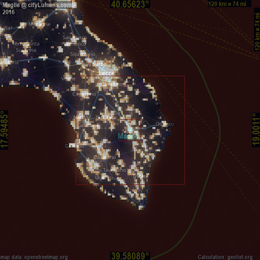
Analysis of Maglie night lights 2016
Square area 10x10 km:
 6.33%
6.33%90-99
12.34%80-89
6.17%70-79
6.17%60-69
3.73%50-59
3.08%40-49
9.42%30-39
12.01%20-29
24.19%10-19
13.47%0-9
3.08%Square area 50x50 km:
2.75%90-99
5.45%80-89
3.72%70-79
3.24%60-69
3.91%50-59
2.68%40-49
3.01%30-39
6.07%20-29
18.46%10-19
18.48%0-9
32.24%Clear (daylight) street map image can be seen on geolist.org.
Map coordinates:
40° 39' 22.4" North, 17° 35' 41.5" East
40° 7' 14.5" North, 18° 17' 52.7" East
39° 34' 51.2" North, 19° 0' 4" East
Some cities around Maglie sort by population:
• Galatina
12.4 km =7.7 mi,  298°
298°
• Martano
9.1 km =5.7 mi,  2°
2°
• Cutrofiano
8.1 km =5 mi,  274°
274°
• Scorrano
3.4 km =2.1 mi,  177°
177°
• Collepasso
12.8 km =8 mi,  244°
244°
• Poggiardo
10.1 km =6.3 mi,  137°
137°
• Corigliano d'Otranto
5.6 km =3.5 mi,  320°
320°
• Soleto
10.8 km =6.7 mi,  313°
313°
3174254 (p: 14,397)
Sources (retrieved 2019-11-25):
» Earth at Night: Flat Maps 2012, 2016