Solaro night lights from space
Night Light of Solaro (Lombardy) from space (Italy) Src. Average luminocity for 10x10km area is 0.3952% and for 50x50km: 10.2895%.
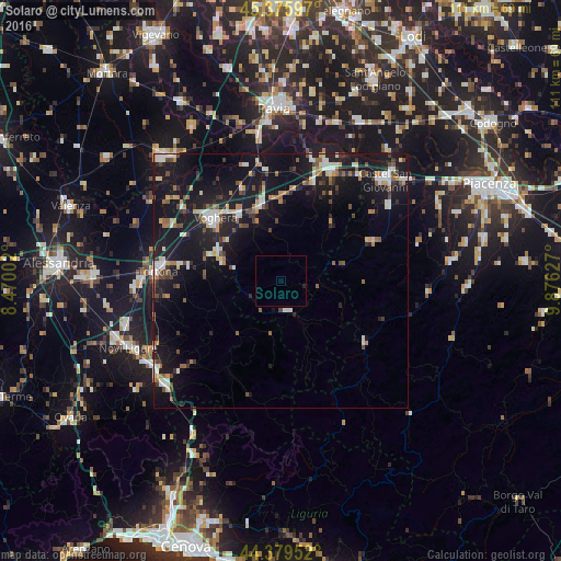
Analysis of Solaro night lights 2016
Square area 10x10 km:
 0%
0%90-99
0%80-89
0%70-79
0%60-69
0%50-59
0%40-49
0%30-39
0%20-29
0.32%10-19
0.32%0-9
99.37%Square area 50x50 km:
1.13%90-99
1.76%80-89
0.92%70-79
0.88%60-69
1.15%50-59
1.32%40-49
1.44%30-39
1.2%20-29
2.19%10-19
15.01%0-9
73%Clear (daylight) street map image can be seen on geolist.org.
Map coordinates:
45° 22' 33.5" North, 8° 28' 12.1" East
44° 52' 47.6" North, 9° 10' 23.3" East
44° 22' 46.3" North, 9° 52' 34.6" East
Some cities around Solaro sort by population:
• Voghera
17.8 km =11.1 mi,  314°
314°
• Tortona
24.5 km =15.2 mi,  274°
274°
• Castel San Giovanni
28.9 km =18 mi,  46°
46°
• Stradella
23.9 km =14.9 mi,  25°
25°
• Broni
21.6 km =13.4 mi,  18°
18°
• Casteggio
15.4 km =9.6 mi,  345°
345°
• Borgonovo Valtidone
26 km =16.2 mi, 54°
• Serravalle Scrivia
30.5 km =19 mi,  235°
235°
3166449 (p: 13,409)
Sources (retrieved 2019-11-25):
» Earth at Night: Flat Maps 2012, 2016