Castel San Giovanni night lights from space
Night Light of Castel San Giovanni (Emilia-Romagna) from space (Italy) Src. Average luminocity for 10x10km area is 29.2015% and for 50x50km: 23.0813%.
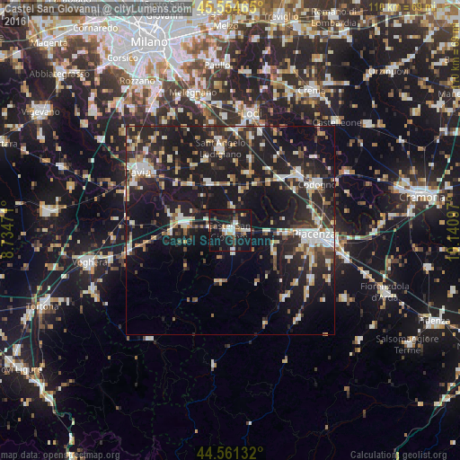
Analysis of Castel San Giovanni night lights 2016
Square area 10x10 km:
 4.7%
4.7%90-99
5.76%80-89
1.36%70-79
2.73%60-69
1.06%50-59
3.48%40-49
4.09%30-39
5.15%20-29
3.33%10-19
58.18%0-9
10.15%Square area 50x50 km:
2.9%90-99
4.22%80-89
2.36%70-79
2.18%60-69
2.41%50-59
2.42%40-49
2.44%30-39
3.58%20-29
10.01%10-19
27.72%0-9
39.76%Clear (daylight) street map image can be seen on geolist.org.
Map coordinates:
45° 33' 16.7" North, 8° 44' 5" East
45° 3' 36.5" North, 9° 26' 16.2" East
44° 33' 40.8" North, 10° 8' 27.5" East
Some cities around Castel San Giovanni sort by population:
• Piacenza
20.1 km =12.5 mi,  92°
92°
• Sant'Angelo Lodigiano
19.6 km =12.2 mi,  352°
352°
• Stradella
10.8 km =6.7 mi,  278°
278°
• San Nicolò
13.2 km =8.2 mi, 91°
• Broni
14 km =8.7 mi,  271°
271°
• San Colombano al Lambro
14.3 km =8.9 mi,  16°
16°
• Belgioioso
14.7 km =9.1 mi,  318°
318°
• Borgonovo Valtidone
5.1 km =3.2 mi,  175°
175°
3179485 (p: 11,308)
Sources (retrieved 2019-11-25):
» Earth at Night: Flat Maps 2012, 2016