Voghera night lights from space
Night Light of Voghera (Lombardy) from space (Italy) Src. Average luminocity for 10x10km area is 37.8095% and for 50x50km: 16.3256%.
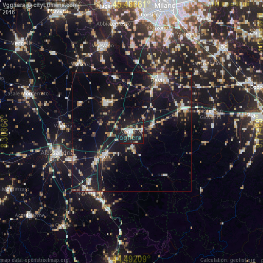
Analysis of Voghera night lights 2016
Square area 10x10 km:
 6.51%
6.51%90-99
7.14%80-89
5.71%70-79
2.22%60-69
3.02%50-59
3.65%40-49
3.65%30-39
3.02%20-29
16.51%10-19
48.1%0-9
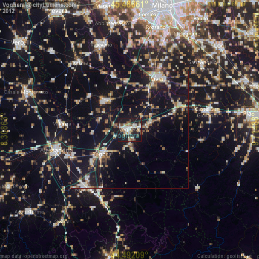
0.48%Square area 50x50 km:
1.79%90-99
2.47%80-89
1.74%70-79
1.58%60-69
1.92%50-59
1.84%40-49
2.12%30-39
1.89%20-29
4.23%10-19
23.11%0-9
57.32%Clear (daylight) street map image can be seen on geolist.org.
Map coordinates:
45° 29' 11.8" North, 8° 18' 31.1" East
44° 59' 29.4" North, 9° 0' 42.3" East
44° 29' 31.5" North, 9° 42' 53.6" East
Some cities around Voghera sort by population:
• Tortona
15.6 km =9.7 mi,  228°
228°
• Solaro
17.8 km =11.1 mi,  134°
134°
• Stradella
24.6 km =15.3 mi,  67°
67°
• Garlasco
23.7 km =14.7 mi,  342°
342°
• Broni
21.1 km =13.1 mi, 67°
• Mede
24.6 km =15.3 mi,  298°
298°
• Casteggio
9.3 km =5.8 mi, 74°
• Sannazzaro de' Burgondi
14.8 km =9.2 mi,  326°
326°
3163995 (p: 36,054)
Sources (retrieved 2019-11-25):
» Earth at Night: Flat Maps 2012, 2016