Santa Croce sull'Arno night lights from space
Night Light of Santa Croce sull'Arno (Tuscany) from space (Italy) Src. Average luminocity for 10x10km area is 62.103% and for 50x50km: 33.2475%.
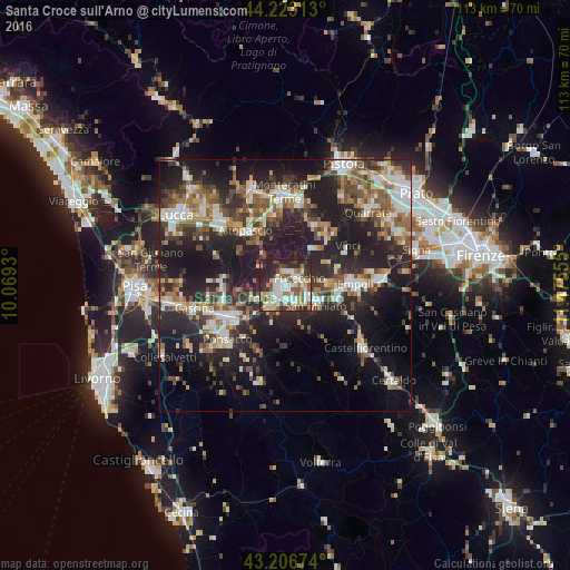
Analysis of Santa Croce sull'Arno night lights 2016
Square area 10x10 km:
 15%
15%90-99
14.85%80-89
6.82%70-79
8.79%60-69
6.36%50-59
8.79%40-49
7.58%30-39
7.12%20-29
22.88%10-19
1.82%0-9
0%Square area 50x50 km:
4.47%90-99
5.95%80-89
3%70-79
3.63%60-69
4.57%50-59
5.31%40-49
5.95%30-39
5.48%20-29
14.42%10-19
21.56%0-9
25.67%Clear (daylight) street map image can be seen on geolist.org.
Map coordinates:
44° 13' 23.3" North, 10° 4' 9.5" East
43° 43' 1.5" North, 10° 46' 20.7" East
43° 12' 24.3" North, 11° 28' 32" East
Some cities around Santa Croce sull'Arno sort by population:
• San Miniato Basso
6.1 km =3.8 mi,  115°
115°
• Pontedera
13 km =8.1 mi,  241°
241°
• San Miniato
7.5 km =4.7 mi, 123°
• Fucecchio
2.7 km =1.7 mi,  48°
48°
• Altopascio
13.4 km =8.3 mi,  325°
325°
• Castelfranco di Sotto
2.6 km =1.6 mi,  234°
234°
• Lamporecchio
13.1 km =8.1 mi,  39°
39°
• Bientina
12.2 km =7.6 mi,  265°
265°
3167658 (p: 11,685)
Sources (retrieved 2019-11-25):
» Earth at Night: Flat Maps 2012, 2016