Castelfranco di Sotto night lights from space
Night Light of Castelfranco di Sotto (Tuscany) from space (Italy) Src. Average luminocity for 10x10km area is 56.5712% and for 50x50km: 31.9836%.
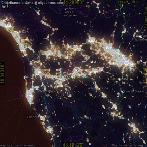
Analysis of Castelfranco di Sotto night lights 2016
Square area 10x10 km:
 13.18%
90-99
13.33%80-89
5.15%70-79
8.03%60-69
4.09%50-59
8.18%40-49
7.58%30-39
5.76%20-29
28.33%10-19
6.36%0-9
0%Square area 50x50 km:
3.96%90-99
5.65%80-89
2.99%70-79
3.5%60-69
4.41%50-59
5.24%40-49
5.73%30-39
5.43%20-29
14.5%10-19
21.22%0-9
27.37%Clear (daylight) street map image can be seen on geolist.org.
Map coordinates:
44° 12' 35.4" North, 10° 2' 35.4" East
43° 42' 13.2" North, 10° 44' 46.7" East
43° 11' 35.6" North, 11° 26' 57.9" East
Some cities around Castelfranco di Sotto sort by population:
• San Miniato Basso
7.7 km =4.8 mi,  98°
98°
• Pontedera
10.4 km =6.5 mi,  243°
243°
• San Miniato
8.7 km =5.4 mi,  107°
107°
• Fucecchio
5.2 km =3.2 mi,  51°
51°
• Santa Croce sull'Arno
2.6 km =1.6 mi, 54°
• Santa Maria a Monte
4.4 km =2.7 mi,  276°
276°
• Vicopisano
13.1 km =8.1 mi,  264°
264°
• Bientina
10.1 km =6.3 mi,  272°
272°
3179687 (p: 8,291)
Sources (retrieved 2019-11-25):
» Earth at Night: Flat Maps 2012, 2016