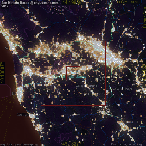
San Miniato Basso night lights from space
Night Light of San Miniato Basso (Tuscany) from space (Italy) Src. Average luminocity for 10x10km area is 50.9273% and for 50x50km: 32.3027%.

Analysis of San Miniato Basso night lights 2016
Square area 10x10 km:
 10%
10%90-99
9.09%80-89
4.24%70-79
8.03%60-69
6.52%50-59
7.88%40-49
9.24%30-39
7.27%20-29
20.3%10-19
17.27%0-9
0.15%Square area 50x50 km:
5.01%90-99
6.28%80-89
2.81%70-79
3.51%60-69
4.31%50-59
5.02%40-49
5.3%30-39
5.02%20-29
12.94%10-19
18.52%0-9
31.3%Clear (daylight) street map image can be seen on geolist.org.
Map coordinates:
44° 11' 58.4" North, 10° 8' 17.1" East
43° 41' 36" North, 10° 50' 28.3" East
43° 10' 58" North, 11° 32' 39.6" East
Some cities around San Miniato Basso sort by population:
• Empoli
9 km =5.6 mi,  72°
72°
• Fucecchio
5.6 km =3.5 mi,  321°
321°
• Santa Croce sull'Arno
6.1 km =3.8 mi,  295°
295°
• Castelfranco di Sotto
7.7 km =4.8 mi,  278°
278°
• Spicchio-Sovigliana
8.9 km =5.5 mi,  62°
62°
• Santa Maria a Monte
12.1 km =7.5 mi, 277°
• Capraia e Limite
12.8 km =8 mi, 63°
• Lamporecchio
13 km =8.1 mi,  12°
12°
3167954 (p: 26,365)
Sources (retrieved 2019-11-25):
» Earth at Night: Flat Maps 2012, 2016