Empoli night lights from space
Night Light of Empoli (Tuscany) from space (Italy) Src. Average luminocity for 10x10km area is 49.7106% and for 50x50km: 32.7707%.
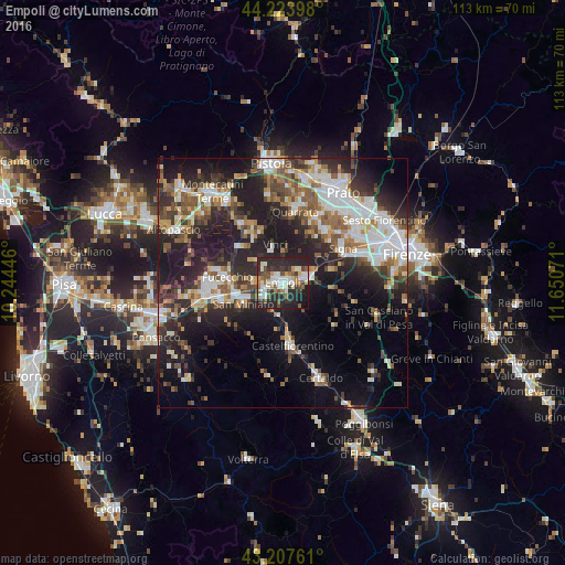
Analysis of Empoli night lights 2016
Square area 10x10 km:
 9.39%
9.39%90-99
11.82%80-89
4.85%70-79
2.88%60-69
6.52%50-59
6.97%40-49
6.97%30-39
6.06%20-29
32.73%10-19
11.52%0-9
0.3%Square area 50x50 km:
6.2%90-99
6.57%80-89
2.57%70-79
3.16%60-69
3.75%50-59
4.76%40-49
5.1%30-39
5.09%20-29
12.27%10-19
17.88%0-9
32.65%Clear (daylight) street map image can be seen on geolist.org.
Map coordinates:
44° 13' 26.3" North, 10° 14' 40.1" East
43° 43' 4.6" North, 10° 56' 51.3" East
43° 12' 27.4" North, 11° 39' 2.6" East
Some cities around Empoli sort by population:
• San Miniato Basso
9 km =5.6 mi,  252°
252°
• San Miniato
8.9 km =5.5 mi,  241°
241°
• Fucecchio
12.2 km =7.6 mi,  277°
277°
• Castelfiorentino
12.2 km =7.6 mi,  172°
172°
• Montelupo Fiorentino
5.2 km =3.2 mi,  75°
75°
• Spicchio-Sovigliana
1.5 km =0.9 mi,  333°
333°
• Capraia e Limite
4.2 km =2.6 mi,  43°
43°
• Lamporecchio
11.4 km =7.1 mi, 330°
3177400 (p: 34,394)
Sources (retrieved 2019-11-25):
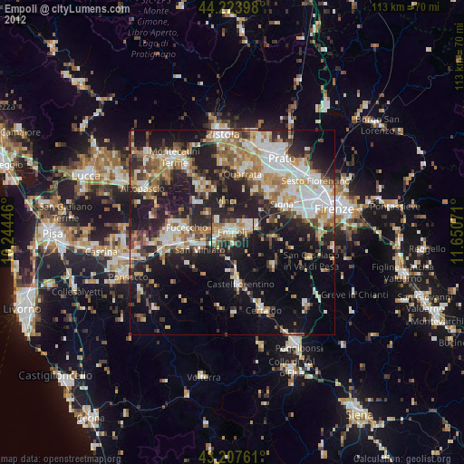
» Earth at Night: Flat Maps 2012, 2016