Riano night lights from space
Night Light of Riano (Latium) from space (Italy) Src. Average luminocity for 10x10km area is 35.5106% and for 50x50km: 36.402%.
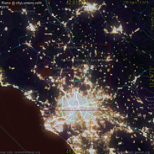
Analysis of Riano night lights 2016
Square area 10x10 km:
 0%
0%90-99
3.03%80-89
3.94%70-79
4.24%60-69
6.97%50-59
7.27%40-49
6.97%30-39
9.7%20-29
31.67%10-19
25.91%0-9
0.3%Square area 50x50 km:
8.8%90-99
7.92%80-89
3.58%70-79
3.68%60-69
3.78%50-59
4.46%40-49
4.29%30-39
4.9%20-29
9.05%10-19
11.99%0-9
37.55%Clear (daylight) street map image can be seen on geolist.org.
Map coordinates:
42° 36' 47.1" North, 11° 48' 41.4" East
42° 5' 36.5" North, 12° 30' 52.6" East
41° 34' 10.5" North, 13° 13' 3.9" East
Some cities around Riano sort by population:
• Monterotondo
9.8 km =6.1 mi,  118°
118°
• Mentana
12.5 km =7.8 mi, 121°
• Fiano Romano
9.5 km =5.9 mi,  43°
43°
• Campagnano di Roma
12.5 km =7.8 mi,  291°
291°
• Rignano Flaminio
12.8 km =8 mi,  347°
347°
• Morlupo
6.4 km =4 mi, 351°
• Capena
6 km =3.7 mi,  24°
24°
• Formello
10.5 km =6.5 mi,  250°
250°
3169443 (p: 6,784)
Sources (retrieved 2019-11-25):
» Earth at Night: Flat Maps 2012, 2016