Mentana night lights from space
Night Light of Mentana (Latium) from space (Italy) Src. Average luminocity for 10x10km area is 53.5111% and for 50x50km: 43.4257%.
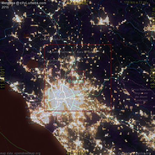
Analysis of Mentana night lights 2016
Square area 10x10 km:
 7.14%
7.14%90-99
12.86%80-89
5.24%70-79
4.92%60-69
6.35%50-59
9.05%40-49
12.38%30-39
18.25%20-29
17.78%10-19
6.03%0-9
0%Square area 50x50 km:
12.08%90-99
10.05%80-89
4.69%70-79
4.87%60-69
4.61%50-59
5.25%40-49
4.4%30-39
4.58%20-29
8.01%10-19
9.66%0-9
31.78%Clear (daylight) street map image can be seen on geolist.org.
Map coordinates:
42° 33' 19.7" North, 11° 56' 27.6" East
42° 2' 7.4" North, 12° 38' 38.9" East
41° 30' 39.6" North, 13° 20' 50.1" East
Some cities around Mentana sort by population:
• Guidonia Montecelio
8 km =5 mi,  125°
125°
• Monterotondo
2.7 km =1.7 mi,  311°
311°
• Guidonia
7.8 km =4.8 mi, 127°
• Tor Lupara
4.7 km =2.9 mi,  207°
207°
• Bagni di Tivoli
11.2 km =7 mi,  147°
147°
• Santa Lucia
6 km =3.7 mi,  170°
170°
• Marco Simone
8.9 km =5.5 mi,  178°
178°
• Palombara Sabina
10.8 km =6.7 mi,  69°
69°
3173582 (p: 17,047)
Sources (retrieved 2019-11-25):
» Earth at Night: Flat Maps 2012, 2016