Rho night lights from space
Night Light of Rho (Lombardy) from space (Italy) Src. Average luminocity for 10x10km area is 95.55% and for 50x50km: 73.2857%.
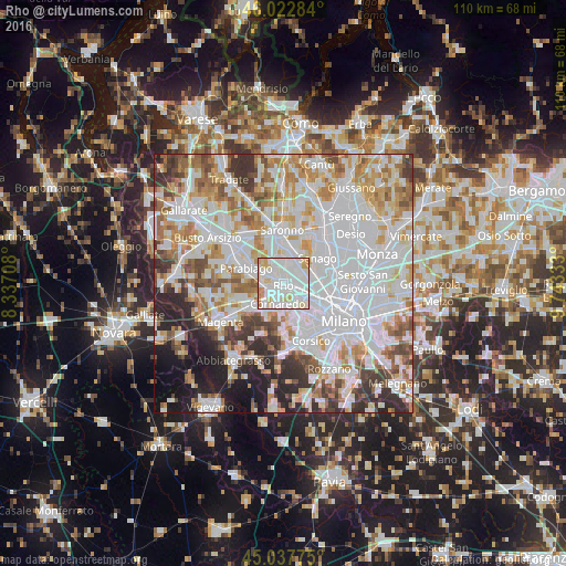
Analysis of Rho night lights 2016
Square area 10x10 km:
 48.64%
90-99
34.24%80-89
9.85%70-79
5.45%60-69
1.82%50-59
0%40-49
0%30-39
0%20-29
0%10-19
0%0-9
0%Square area 50x50 km:
28.4%90-99
18.5%80-89
6.94%70-79
7.97%60-69
8.38%50-59
5.5%40-49
5.18%30-39
5.51%20-29
6.58%10-19
5.62%0-9
1.41%Clear (daylight) street map image can be seen on geolist.org.
Map coordinates:
46° 1' 22.2" North, 8° 20' 13.5" East
45° 31' 56.8" North, 9° 2' 24.7" East
45° 2' 15.9" North, 9° 44' 36" East
Some cities around Rho sort by population:
• Lainate
4.5 km =2.8 mi,  346°
346°
• Cornaredo
3.6 km =2.2 mi,  196°
196°
• Arese
3.5 km =2.2 mi,  55°
55°
• Nerviano
5.3 km =3.3 mi,  296°
296°
• Pero
4.4 km =2.7 mi,  124°
124°
• Pogliano Milanese
3.6 km =2.2 mi,  279°
279°
• Vanzago
3.9 km =2.4 mi,  258°
258°
• Pregnana Milanese
3.2 km =2 mi,  234°
234°
3169447 (p: 47,086)
Sources (retrieved 2019-11-25):
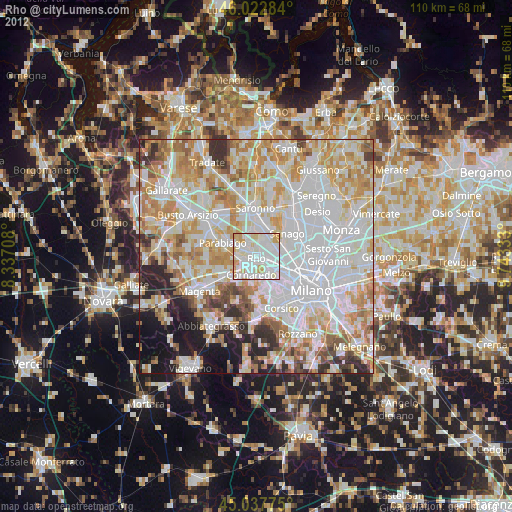
» Earth at Night: Flat Maps 2012, 2016