Pero night lights from space
Night Light of Pero (Lombardy) from space (Italy) Src. Average luminocity for 10x10km area is 97.8667% and for 50x50km: 73.073%.
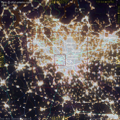
Analysis of Pero night lights 2016
Square area 10x10 km:
 62.86%
90-99
29.37%80-89
5.56%70-79
1.11%60-69
1.11%50-59
0%40-49
0%30-39
0%20-29
0%10-19
0%0-9
0%Square area 50x50 km:
28.63%90-99
18.65%80-89
6.87%70-79
7.77%60-69
8.11%50-59
5.06%40-49
4.75%30-39
5.24%20-29
7.22%10-19
6.76%0-9
0.95%Clear (daylight) street map image can be seen on geolist.org.
Map coordinates:
46° 0' 2.7" North, 8° 23' 2.1" East
45° 30' 36.6" North, 9° 5' 13.3" East
45° 0' 55" North, 9° 47' 24.6" East
Some cities around Pero sort by population:
• Rho
4.4 km =2.7 mi,  304°
304°
• Bollate
4.8 km =3 mi,  32°
32°
• Cornaredo
4.8 km =3 mi,  258°
258°
• Novate Milanese
4.7 km =2.9 mi,  61°
61°
• Arese
4.5 km =2.8 mi,  350°
350°
• Settimo Milanese
4.4 km =2.7 mi,  214°
214°
• Baranzate
3 km =1.9 mi,  51°
51°
• Pregnana Milanese
6.3 km =3.9 mi,  275°
275°
6534238 (p: 9,626)
Sources (retrieved 2019-11-25):
» Earth at Night: Flat Maps 2012, 2016