Quartu Sant'Elena night lights from space
Night Light of Quartu Sant'Elena (Sardinia) from space (Italy) Src. Average luminocity for 10x10km area is 32.9422% and for 50x50km: 13.9919%.
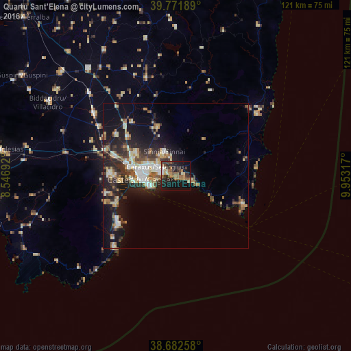
Analysis of Quartu Sant'Elena night lights 2016
Square area 10x10 km:
 1.19%
1.19%90-99
4.59%80-89
2.55%70-79
4.08%60-69
9.18%50-59
5.61%40-49
4.59%30-39
9.35%20-29
11.9%10-19
30.78%0-9
16.16%Square area 50x50 km:
1.64%90-99
2.66%80-89
1.7%70-79
1.49%60-69
2.12%50-59
1.44%40-49
1.78%30-39
2.28%20-29
4.87%10-19
10.24%0-9
69.78%Clear (daylight) street map image can be seen on geolist.org.
Map coordinates:
39° 46' 18.8" North, 8° 32' 48.9" East
39° 13' 45.7" North, 9° 15' 0.1" East
38° 40' 57.3" North, 9° 57' 11.4" East
Some cities around Quartu Sant'Elena sort by population:
• Cagliari
11.3 km =7 mi,  270°
270°
• Selargius
8.1 km =5 mi,  292°
292°
• Monserrato
9.6 km =6 mi, 288°
• Sestu
15.6 km =9.7 mi,  299°
299°
• Sinnai
9.1 km =5.7 mi,  333°
333°
• Dolianova
17.7 km =11 mi,  339°
339°
• Maracalagonis
6.5 km =4 mi, 343°
• Settimo San Pietro
8.8 km =5.5 mi,  321°
321°
2523665 (p: 66,620)
Sources (retrieved 2019-11-25):
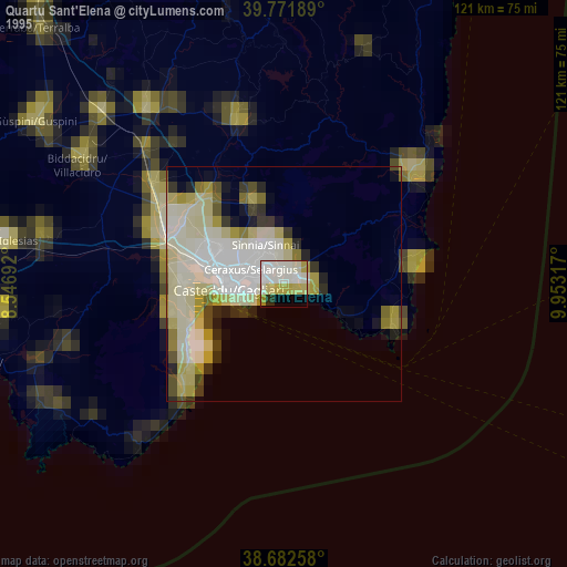
» NASA, Earths city lights 1995
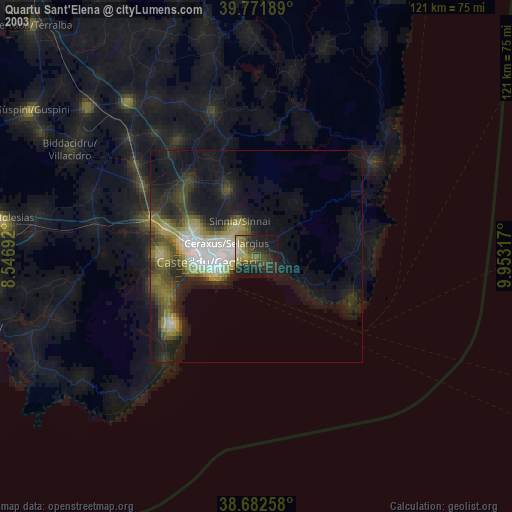
» NASA city lights 2003
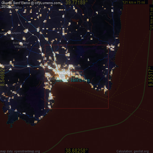
» Earth at Night: Flat Maps 2012, 2016