Palma di Montechiaro night lights from space
Night Light of Palma di Montechiaro (Sicily) from space (Italy) Src. Average luminocity for 10x10km area is 14.1599% and for 50x50km: 10.2008%.
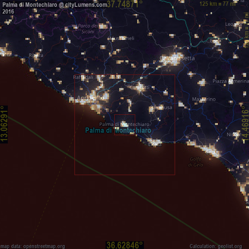
Analysis of Palma di Montechiaro night lights 2016
Square area 10x10 km:
 1.53%
1.53%90-99
2.21%80-89
2.55%70-79
1.87%60-69
1.36%50-59
2.04%40-49
0%30-39
2.21%20-29
1.53%10-19
1.36%0-9
83.33%Square area 50x50 km:
1.13%90-99
1.16%80-89
1.72%70-79
0.93%60-69
1.17%50-59
1.22%40-49
0.85%30-39
2.25%20-29
2.34%10-19
8.62%0-9
78.59%Clear (daylight) street map image can be seen on geolist.org.
Map coordinates:
37° 44' 55.4" North, 13° 3' 46.5" East
37° 11' 26.4" North, 13° 45' 57.7" East
36° 37' 42.5" North, 14° 28' 9" East
Some cities around Palma di Montechiaro sort by population:
• Licata
18.2 km =11.3 mi,  122°
122°
• Canicattì
20 km =12.4 mi,  21°
21°
• Agrigento
21.4 km =13.3 mi,  308°
308°
• Favara
16.8 km =10.4 mi,  326°
326°
• San Leone Mosè
18.1 km =11.2 mi,  297°
297°
• Ravanusa
19.8 km =12.3 mi,  64°
64°
• Campobello di Licata
15.4 km =9.6 mi, 61°
• Naro
11.6 km =7.2 mi,  12°
12°
2523908 (p: 22,654)
Sources (retrieved 2019-11-25):
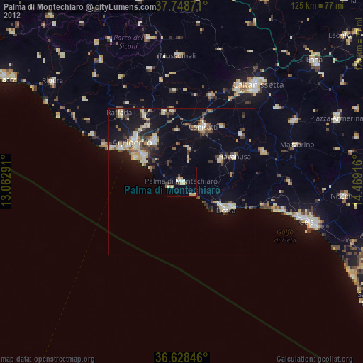
» Earth at Night: Flat Maps 2012, 2016