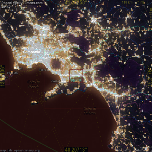
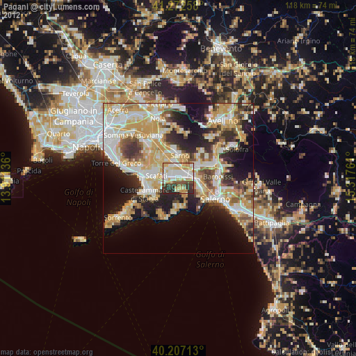
Pagani night lights from space
Night Light of Pagani (Campania) from space (Italy) Src. Average luminocity for 10x10km area is 71.2711% and for 50x50km: 42.1088%.
Analysis of Pagani night lights 2016
Square area 10x10 km:
 17.37%
90-99
22.56%80-89
7.47%70-79
9.74%60-69
6.17%50-59
7.31%40-49
9.42%30-39
11.85%20-29
8.12%10-19
0%0-9
0%Square area 50x50 km:
7.49%90-99
9.44%80-89
5.09%70-79
5.95%60-69
6.83%50-59
6.08%40-49
4.69%30-39
6.83%20-29
9.6%10-19
12.2%0-9
25.81%Clear (daylight) street map image can be seen on geolist.org.
Map coordinates:
41° 16' 21.3" North, 13° 54' 40.9" East
40° 44' 31.2" North, 14° 36' 52.1" East
40° 12' 25.7" North, 15° 19' 3.4" East
Some cities around Pagani sort by population:
• Nocera Inferiore
2.6 km =1.6 mi,  81°
81°
• Angri
3.7 km =2.3 mi,  263°
263°
• Nocera Superiore
5.1 km =3.2 mi,  89°
89°
• San Marzano sul Sarno
4.9 km =3 mi,  324°
324°
• San Valentino Torio
5.5 km =3.4 mi,  350°
350°
• Sant'Egidio del Monte Albino
1.7 km =1.1 mi, 257°
• Roccapiemonte
6.7 km =4.2 mi,  72°
72°
• Lanzara
6.3 km =3.9 mi,  54°
54°
3171703 (p: 32,835)
Sources (retrieved 2019-11-25):
» Earth at Night: Flat Maps 2012, 2016