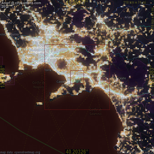
Angri night lights from space
Night Light of Angri (Campania) from space (Italy) Src. Average luminocity for 10x10km area is 77.362% and for 50x50km: 42.1255%.
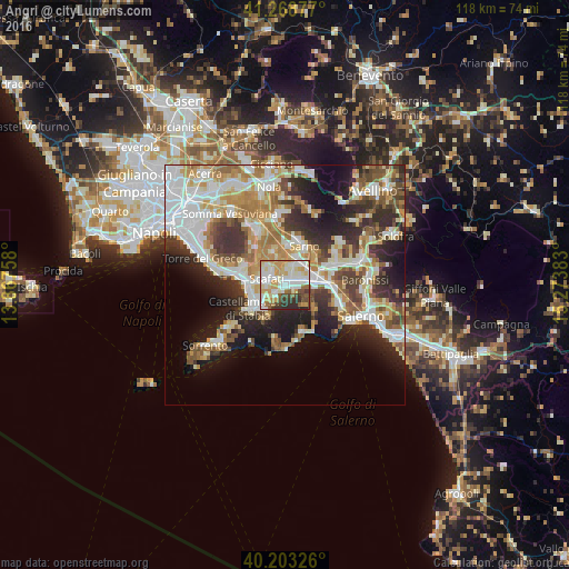
Analysis of Angri night lights 2016
Square area 10x10 km:
 18.18%
90-99
25.49%80-89
12.5%70-79
14.94%60-69
5.52%50-59
4.87%40-49
6.01%30-39
6.66%20-29
5.84%10-19
0%0-9
0%Square area 50x50 km:
9.08%90-99
9.68%80-89
4.76%70-79
5.66%60-69
6.46%50-59
5.33%40-49
4.26%30-39
6.39%20-29
9.04%10-19
10.99%0-9
28.34%Clear (daylight) street map image can be seen on geolist.org.
Map coordinates:
41° 16' 7.6" North, 13° 52' 3.3" East
40° 44' 17.3" North, 14° 34' 14.5" East
40° 12' 11.7" North, 15° 16' 25.8" East
Some cities around Angri sort by population:
• Scafati
3.7 km =2.3 mi,  311°
311°
• Nocera Inferiore
6.3 km =3.9 mi,  82°
82°
• Pagani
3.7 km =2.3 mi, 83°
• Sant'Antonio Abate
3.2 km =2 mi,  234°
234°
• Santa Maria La Carità
5.7 km =3.5 mi,  244°
244°
• San Marzano sul Sarno
4.5 km =2.8 mi,  10°
10°
• Sant'Egidio del Monte Albino
2 km =1.2 mi,  88°
88°
• Lettere
4.3 km =2.7 mi,  210°
210°
3183063 (p: 31,632)
Sources (retrieved 2019-11-25):
» Earth at Night: Flat Maps 2012, 2016