Massa di Somma night lights from space
Night Light of Massa di Somma (Campania) from space (Italy) Src. Average luminocity for 10x10km area is 78.8248% and for 50x50km: 52.6584%.
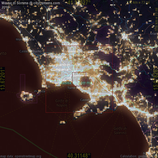
Analysis of Massa di Somma night lights 2016
Square area 10x10 km:
 32.82%
90-99
21.09%80-89
7.14%70-79
6.46%60-69
6.12%50-59
5.1%40-49
5.61%30-39
14.46%20-29
1.19%10-19
0%0-9
0%Square area 50x50 km:
13.82%90-99
13.18%80-89
5.46%70-79
7.25%60-69
7.92%50-59
5.36%40-49
4.14%30-39
6.31%20-29
9.84%10-19
9.46%0-9
17.25%Clear (daylight) street map image can be seen on geolist.org.
Map coordinates:
41° 22' 31" North, 13° 40' 19.2" East
40° 50' 43.8" North, 14° 22' 30.5" East
40° 18' 41.3" North, 15° 4' 41.7" East
Some cities around Massa di Somma sort by population:
• Portici
4.6 km =2.9 mi,  223°
223°
• Ponticelli
3.9 km =2.4 mi,  284°
284°
• San Giorgio a Cremano
3.2 km =2 mi,  243°
243°
• Volla
4.3 km =2.7 mi,  317°
317°
• Sant'Anastasia
3.4 km =2.1 mi,  41°
41°
• Cercola
2.2 km =1.4 mi, 317°
• Pollena Trocchia
0.7 km =0.4 mi,  27°
27°
• San Sebastiano al Vesuvio
0.9 km =0.6 mi,  255°
255°
6535637 (p: 5,573)
Sources (retrieved 2019-11-25):
» Earth at Night: Flat Maps 2012, 2016