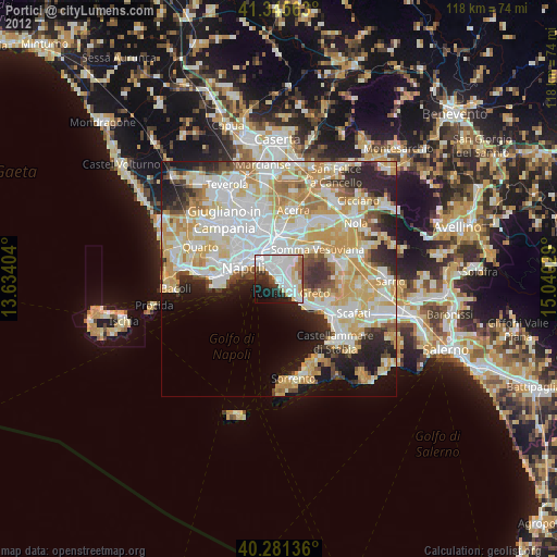
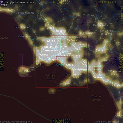
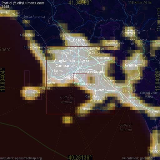
Portici night lights from space
Night Light of Portici (Campania) from space (Italy) Src. Average luminocity for 10x10km area is 69.4813% and for 50x50km: 50.0342%.
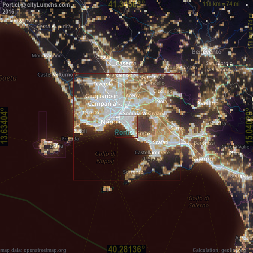
Analysis of Portici night lights 2016
Square area 10x10 km:
 30.44%
90-99
20.07%80-89
3.23%70-79
4.59%60-69
4.59%50-59
3.4%40-49
2.21%30-39
8.5%20-29
13.27%10-19
7.82%0-9
1.87%Square area 50x50 km:
13.15%90-99
12.73%80-89
5.35%70-79
7.03%60-69
7.76%50-59
5.34%40-49
3.42%30-39
5.49%20-29
8.33%10-19
7.78%0-9
23.63%Clear (daylight) street map image can be seen on geolist.org.
Map coordinates:
41° 20' 44.3" North, 13° 38' 2.5" East
40° 48' 56.3" North, 14° 20' 13.8" East
40° 16' 52.9" North, 15° 2' 25" East
Some cities around Portici sort by population:
• Torre del Greco
3.9 km =2.4 mi,  138°
138°
• Ercolano
1.4 km =0.9 mi,  128°
128°
• Ponticelli
4.3 km =2.7 mi,  352°
352°
• San Giorgio a Cremano
1.9 km =1.2 mi,  11°
11°
• Barra
3.4 km =2.1 mi,  332°
332°
• San Giovanni a Teduccio
3.6 km =2.2 mi,  313°
313°
• San Sebastiano al Vesuvio
3.8 km =2.4 mi,  36°
36°
• Massa di Somma
4.6 km =2.9 mi, 43°
3170116 (p: 55,765)
Sources (retrieved 2019-11-25):
» NASA, Earths city lights 1995
» NASA city lights 2003
» Earth at Night: Flat Maps 2012, 2016