Magnago night lights from space
Night Light of Magnago (Lombardy) from space (Italy) Src. Average luminocity for 10x10km area is 75.6894% and for 50x50km: 54.8681%.
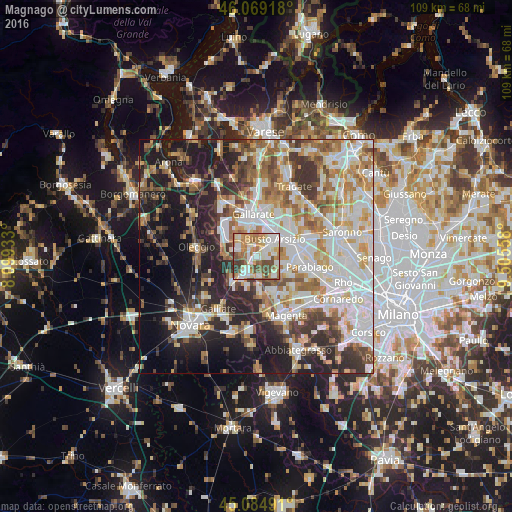
Analysis of Magnago night lights 2016
Square area 10x10 km:
 16.06%
90-99
22.42%80-89
8.18%70-79
11.97%60-69
16.52%50-59
9.09%40-49
11.36%30-39
4.09%20-29
0.3%10-19
0%0-9
0%Square area 50x50 km:
13.12%90-99
13.86%80-89
5.59%70-79
6.67%60-69
7.79%50-59
6.47%40-49
5.94%30-39
6.73%20-29
11%10-19
13.91%0-9
8.93%Clear (daylight) street map image can be seen on geolist.org.
Map coordinates:
46° 4' 9" North, 8° 5' 57.6" East
45° 34' 45.1" North, 8° 48' 8.8" East
45° 5' 5.7" North, 9° 30' 20.1" East
Some cities around Magnago sort by population:
• Busto Arsizio
5.1 km =3.2 mi,  45°
45°
• Samarate
5.2 km =3.2 mi,  344°
344°
• Lonate Pozzolo
4.2 km =2.6 mi,  290°
290°
• Castano Primo
3.7 km =2.3 mi,  214°
214°
• Arconate
5.6 km =3.5 mi,  139°
139°
• Ferno
5.3 km =3.3 mi,  318°
318°
• Dairago
4.9 km =3 mi,  107°
107°
• Vanzaghello
1.6 km =1 mi,  271°
271°
3174250 (p: 8,726)
Sources (retrieved 2019-11-25):
» Earth at Night: Flat Maps 2012, 2016