Busto Arsizio night lights from space
Night Light of Busto Arsizio (Lombardy) from space (Italy) Src. Average luminocity for 10x10km area is 89.8985% and for 50x50km: 61.3255%.
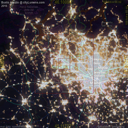
Analysis of Busto Arsizio night lights 2016
Square area 10x10 km:
 36.36%
90-99
33.18%80-89
6.06%70-79
9.85%60-69
9.55%50-59
2.27%40-49
2.73%30-39
0%20-29
0%10-19
0%0-9
0%Square area 50x50 km:
17.24%90-99
15.7%80-89
5.86%70-79
7.11%60-69
8.07%50-59
6.73%40-49
6.56%30-39
6.96%20-29
10.31%10-19
12.25%0-9
3.22%Clear (daylight) street map image can be seen on geolist.org.
Map coordinates:
46° 6' 3.5" North, 8° 8' 45.7" East
45° 36' 40.6" North, 8° 50' 56.9" East
45° 7' 2.2" North, 9° 33' 8.2" East
Some cities around Busto Arsizio sort by population:
• Castellanza
3.7 km =2.3 mi,  90°
90°
• Samarate
5.2 km =3.2 mi,  285°
285°
• Olgiate Olona
3.8 km =2.4 mi,  41°
41°
• Magnago
5.1 km =3.2 mi,  225°
225°
• Gorla Minore
5.3 km =3.3 mi,  51°
51°
• Marnate
5 km =3.1 mi,  67°
67°
• Dairago
5.2 km =3.2 mi,  168°
168°
• Solbiate Olona
5 km =3.1 mi,  30°
30°
3181355 (p: 79,519)
Sources (retrieved 2019-11-25):
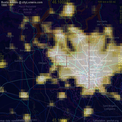
» NASA, Earths city lights 1995
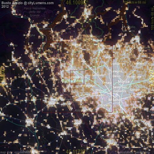
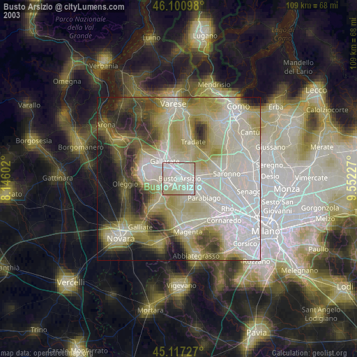
» NASA city lights 2003
» Earth at Night: Flat Maps 2012, 2016