Arconate night lights from space
Night Light of Arconate (Lombardy) from space (Italy) Src. Average luminocity for 10x10km area is 74.1485% and for 50x50km: 57.4704%.
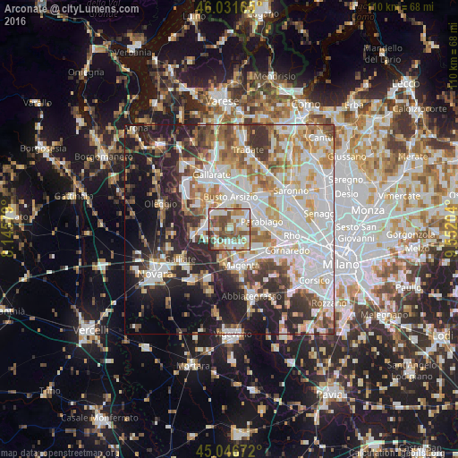
Analysis of Arconate night lights 2016
Square area 10x10 km:
 17.58%
90-99
20.61%80-89
7.58%70-79
9.55%60-69
15.15%50-59
9.39%40-49
15.3%30-39
3.79%20-29
1.06%10-19
0%0-9
0%Square area 50x50 km:
16.68%90-99
14.51%80-89
5.3%70-79
6.62%60-69
7.26%50-59
5.58%40-49
5.63%30-39
6.39%20-29
10.72%10-19
13.23%0-9
8.07%Clear (daylight) street map image can be seen on geolist.org.
Map coordinates:
46° 1' 53.9" North, 8° 8' 44.8" East
45° 32' 28.8" North, 8° 50' 56.1" East
45° 2' 48.2" North, 9° 33' 7.3" East
Some cities around Arconate sort by population:
• Busto Garolfo
2.8 km =1.7 mi,  74°
74°
• Castano Primo
5.8 km =3.6 mi,  281°
281°
• Magnago
5.6 km =3.5 mi,  319°
319°
• Cuggiono
4.6 km =2.9 mi,  214°
214°
• Inveruno
3 km =1.9 mi,  179°
179°
• Villa Cortese
4.1 km =2.5 mi,  46°
46°
• Dairago
2.9 km =1.8 mi,  21°
21°
• Casorezzo
4.6 km =2.9 mi,  116°
116°
3182906 (p: 6,475)
Sources (retrieved 2019-11-25):
» Earth at Night: Flat Maps 2012, 2016