Matera night lights from space
Night Light of Matera (Basilicate) from space (Italy) Src. Average luminocity for 10x10km area is 36.2175% and for 50x50km: 8.3764%.
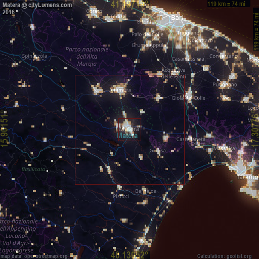
Analysis of Matera night lights 2016
Square area 10x10 km:
 8.44%
8.44%90-99
9.58%80-89
3.57%70-79
2.44%60-69
1.62%50-59
1.46%40-49
3.25%30-39
4.87%20-29
13.31%10-19
33.44%0-9
18.02%Square area 50x50 km:
1.02%90-99
1.49%80-89
0.86%70-79
0.68%60-69
0.83%50-59
0.82%40-49
0.72%30-39
1.07%20-29
1.73%10-19
6.77%0-9
84%Clear (daylight) street map image can be seen on geolist.org.
Map coordinates:
41° 11' 49.9" North, 15° 54' 5.4" East
40° 39' 57.6" North, 16° 36' 16.7" East
40° 7' 49.9" North, 17° 18' 27.9" East
Some cities around Matera sort by population:
• Altamura
18.5 km =11.5 mi,  345°
345°
• Gravina in Puglia
23 km =14.3 mi,  317°
317°
• Santeramo in Colle
19.1 km =11.9 mi,  42°
42°
• Ginosa
16.2 km =10.1 mi,  127°
127°
• Laterza
16.9 km =10.5 mi,  104°
104°
• Montescaglioso
13.9 km =8.6 mi,  158°
158°
• Ferrandina
22.4 km =13.9 mi,  214°
214°
• Grassano
27.8 km =17.3 mi,  262°
262°
3173721 (p: 54,891)
Sources (retrieved 2019-11-25):
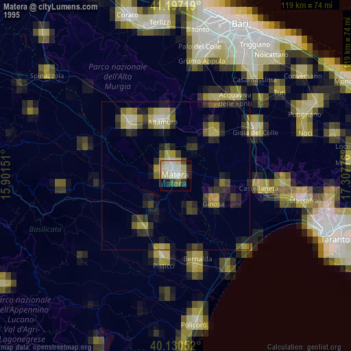
» NASA, Earths city lights 1995
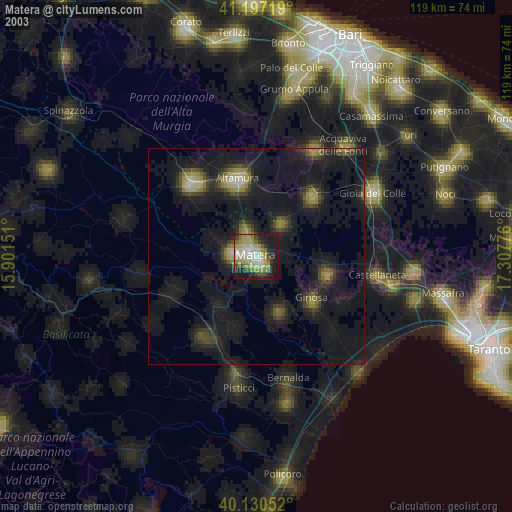
» NASA city lights 2003
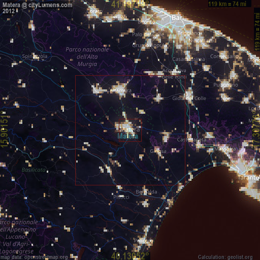
» Earth at Night: Flat Maps 2012, 2016