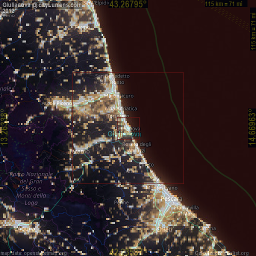
Giulianova night lights from space
Night Light of Giulianova (Abruzzo) from space (Italy) Src. Average luminocity for 10x10km area is 42.5939% and for 50x50km: 21.9927%.
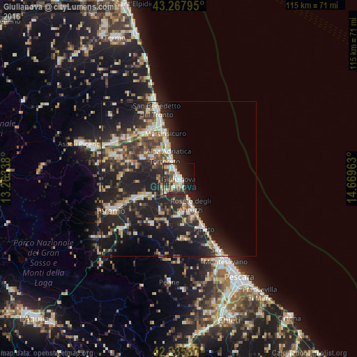
Analysis of Giulianova night lights 2016
Square area 10x10 km:
 7.73%
7.73%90-99
10%80-89
4.09%70-79
3.64%60-69
2.27%50-59
6.97%40-49
7.73%30-39
6.52%20-29
18.79%10-19
19.55%0-9
12.73%Square area 50x50 km:
2.43%90-99
4.05%80-89
2.3%70-79
2.39%60-69
2.57%50-59
2.68%40-49
3.48%30-39
4.15%20-29
11.12%10-19
17.47%0-9
47.35%Clear (daylight) street map image can be seen on geolist.org.
Map coordinates:
43° 16' 4.6" North, 13° 15' 48.2" East
42° 45' 13.7" North, 13° 57' 59.4" East
42° 14' 7.3" North, 14° 40' 10.7" East
Some cities around Giulianova sort by population:
• Roseto degli Abruzzi
10 km =6.2 mi,  156°
156°
• Alba Adriatica
9.3 km =5.8 mi,  339°
339°
• Martinsicuro
14.7 km =9.1 mi, 342°
• Centobuchi
18.5 km =11.5 mi,  328°
328°
• Tortoreto Lido
5.5 km =3.4 mi, 338°
• Atri
19.8 km =12.3 mi,  174°
174°
• Pineto
18.1 km =11.2 mi,  153°
153°
• San Nicolò a Tordino
15.2 km =9.4 mi,  245°
245°
3176053 (p: 20,490)
Sources (retrieved 2019-11-25):
» Earth at Night: Flat Maps 2012, 2016