Centobuchi night lights from space
Night Light of Centobuchi (The Marches) from space (Italy) Src. Average luminocity for 10x10km area is 60.5778% and for 50x50km: 20.6151%.
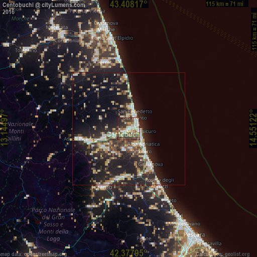
Analysis of Centobuchi night lights 2016
Square area 10x10 km:
 9.68%
9.68%90-99
14.13%80-89
6.83%70-79
8.57%60-69
7.46%50-59
11.59%40-49
12.06%30-39
15.4%20-29
10.79%10-19
3.49%0-9
0%Square area 50x50 km:
2.2%90-99
3.62%80-89
2.44%70-79
2.18%60-69
2.12%50-59
2.81%40-49
3.38%30-39
3.91%20-29
8.96%10-19
16.92%0-9
51.44%Clear (daylight) street map image can be seen on geolist.org.
Map coordinates:
43° 24' 29.4" North, 13° 8' 41.9" East
42° 53' 42.8" North, 13° 50' 53.1" East
42° 22' 40.6" North, 14° 33' 4.4" East
Some cities around Centobuchi sort by population:
• San Benedetto del Tronto
7.2 km =4.5 mi,  18°
18°
• Grottammare
9.8 km =6.1 mi,  9°
9°
• Alba Adriatica
9.5 km =5.9 mi,  138°
138°
• Martinsicuro
5.6 km =3.5 mi,  107°
107°
• Sant'Egidio alla Vibrata
13.5 km =8.4 mi,  229°
229°
• Piattoni-Villa Sant'Antonio
11.6 km =7.2 mi,  253°
253°
• Castel di Lama
11 km =6.8 mi, 251°
• Tortoreto Lido
13.1 km =8.1 mi, 144°
8468835 (p: 8,384)
Sources (retrieved 2019-11-25):
» Earth at Night: Flat Maps 2012, 2016