Fabrica di Roma night lights from space
Night Light of Fabrica di Roma (Latium) from space (Italy) Src. Average luminocity for 10x10km area is 13.2921% and for 50x50km: 12.7533%.
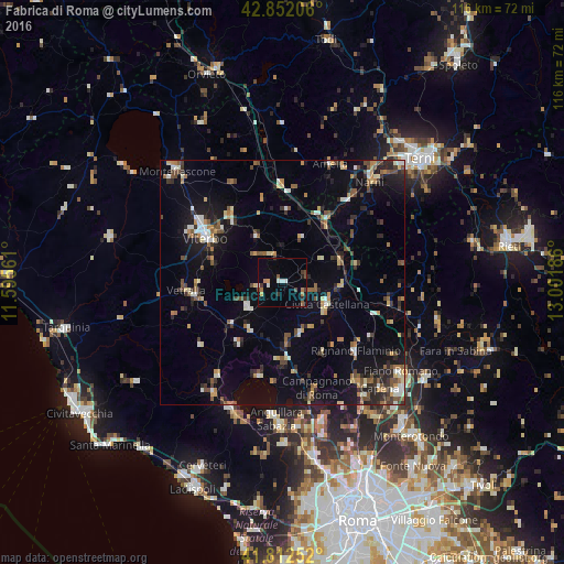
Analysis of Fabrica di Roma night lights 2016
Square area 10x10 km:
 0.32%
0.32%90-99
2.86%80-89
0.48%70-79
1.27%60-69
2.06%50-59
1.59%40-49
2.54%30-39
2.06%20-29
1.75%10-19
1.59%0-9
83.49%Square area 50x50 km:
0.74%90-99
2%80-89
1.25%70-79
1.41%60-69
1.33%50-59
1.95%40-49
2.05%30-39
1.89%20-29
2.99%10-19
7.78%0-9
76.62%Clear (daylight) street map image can be seen on geolist.org.
Map coordinates:
42° 51' 7.4" North, 11° 35' 44.2" East
42° 20' 4" North, 12° 17' 55.4" East
41° 48' 45.1" North, 13° 0' 6.7" East
Some cities around Fabrica di Roma sort by population:
• Viterbo
18.5 km =11.5 mi,  300°
300°
• Civita Castellana
10.2 km =6.3 mi,  116°
116°
• Vetralla
18.6 km =11.6 mi,  264°
264°
• Ronciglione
8.6 km =5.3 mi,  233°
233°
• Rignano Flaminio
20.7 km =12.9 mi,  133°
133°
• Nepi
10.9 km =6.8 mi,  160°
160°
• Soriano nel Cimino
10.7 km =6.6 mi,  330°
330°
• Capranica
13.4 km =8.3 mi, 230°
3177314 (p: 5,108)
Sources (retrieved 2019-11-25):
» Earth at Night: Flat Maps 2012, 2016