Cles night lights from space
Night Light of Cles (Trentino-Alto Adige) from space (Italy) Src. Average luminocity for 10x10km area is 19.4241% and for 50x50km: 6.3456%.
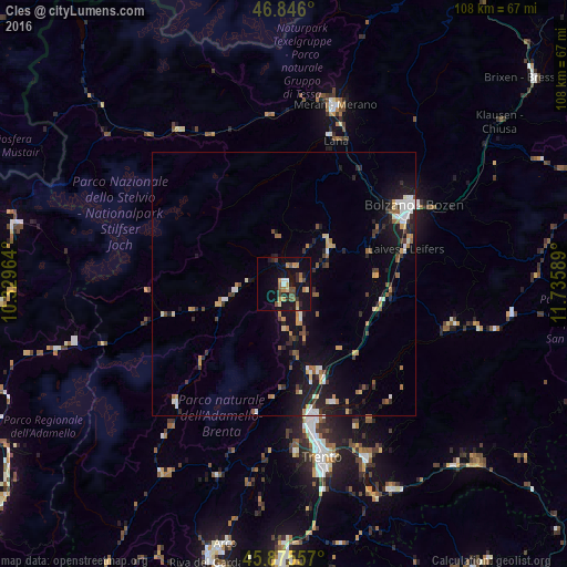
Analysis of Cles night lights 2016
Square area 10x10 km:
 0.89%
0.89%90-99
1.04%80-89
1.93%70-79
4.76%60-69
2.53%50-59
2.98%40-49
4.46%30-39
1.64%20-29
4.32%10-19
24.55%0-9
50.89%Square area 50x50 km:
0.61%90-99
0.88%80-89
0.53%70-79
0.93%60-69
0.84%50-59
0.71%40-49
0.8%30-39
0.81%20-29
1.74%10-19
5.45%0-9
86.71%Clear (daylight) street map image can be seen on geolist.org.
Map coordinates:
46° 50' 45.6" North, 10° 19' 46.7" East
46° 21' 46.6" North, 11° 1' 57.9" East
45° 52' 32.1" North, 11° 44' 9.2" East
Some cities around Cles sort by population:
• Bolzano
27.5 km =17.1 mi,  58°
58°
• Trento
33.5 km =20.8 mi,  168°
168°
• Laives
24.5 km =15.2 mi,  73°
73°
• Lana
29.3 km =18.2 mi,  18°
18°
• Mezzolombardo
17.9 km =11.1 mi,  164°
164°
• Lavis
25.3 km =15.7 mi, 166°
• Caldaro sulla Strada del Vino
17.3 km =10.7 mi, 71°
• San Michele
20.3 km =12.6 mi, 59°
3178548 (p: 5,903)
Sources (retrieved 2019-11-25):
» Earth at Night: Flat Maps 2012, 2016