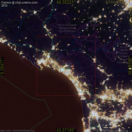
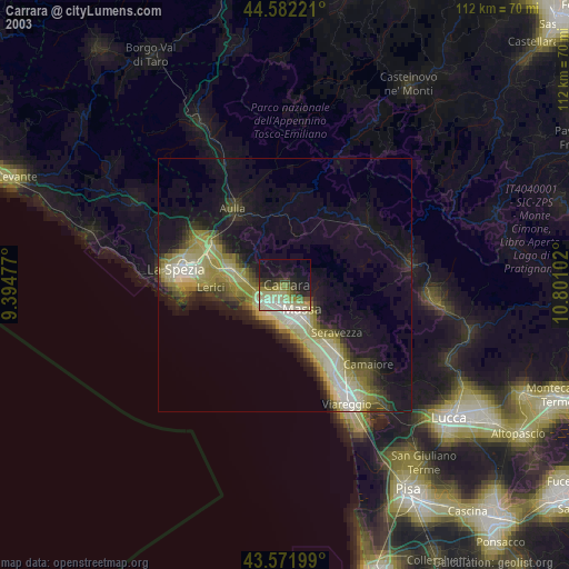
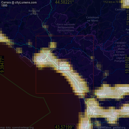
Carrara night lights from space
Night Light of Carrara (Tuscany) from space (Italy) Src. Average luminocity for 10x10km area is 42.1712% and for 50x50km: 15.3336%.

Analysis of Carrara night lights 2016
Square area 10x10 km:
 10.91%
90-99
9.39%80-89
1.97%70-79
3.18%60-69
3.18%50-59
5%40-49
6.06%30-39
9.85%20-29
14.7%10-19
19.09%0-9
16.67%Square area 50x50 km:
2.47%90-99
3.04%80-89
1.39%70-79
1.53%60-69
1.63%50-59
2.3%40-49
2.36%30-39
2.67%20-29
5.96%10-19
8.25%0-9
68.41%Clear (daylight) street map image can be seen on geolist.org.
Map coordinates:
44° 34' 56" North, 9° 23' 41.2" East
44° 4' 45.3" North, 10° 5' 52.4" East
43° 34' 19.2" North, 10° 48' 3.7" East
Some cities around Carrara sort by population:
• Massa
5.9 km =3.7 mi,  145°
145°
• Marina di Carrara
6.4 km =4 mi,  224°
224°
• Sarzana
11.4 km =7.1 mi,  288°
288°
• Marina di Massa
8.4 km =5.2 mi,  175°
175°
• Montignoso
8.6 km =5.3 mi,  135°
135°
• Capanne-Prato-Cinquale
10.3 km =6.4 mi, 152°
• Colombiera-Molicciara
7.1 km =4.4 mi,  277°
277°
• Casano-Dogana-Isola
5.1 km =3.2 mi,  265°
265°
3180423 (p: 58,666)
Sources (retrieved 2019-11-25):
» NASA, Earths city lights 1995
» NASA city lights 2003
» Earth at Night: Flat Maps 2012, 2016