Sarzana night lights from space
Night Light of Sarzana (Liguria) from space (Italy) Src. Average luminocity for 10x10km area is 44.9758% and for 50x50km: 13.4691%.
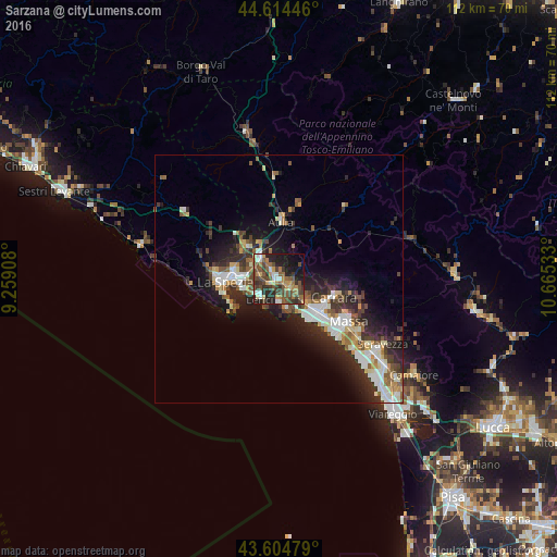

Analysis of Sarzana night lights 2016
Square area 10x10 km:
 5%
5%90-99
4.85%80-89
4.55%70-79
5.3%60-69
9.09%50-59
9.55%40-49
15.76%30-39
8.79%20-29
15.76%10-19
16.97%0-9
4.39%Square area 50x50 km:
2.14%90-99
2.62%80-89
1.23%70-79
1.31%60-69
1.52%50-59
1.97%40-49
2.15%30-39
2.23%20-29
5.27%10-19
7.31%0-9
72.25%Clear (daylight) street map image can be seen on geolist.org.
Map coordinates:
44° 36' 52.1" North, 9° 15' 32.7" East
44° 6' 42.4" North, 9° 57' 43.9" East
43° 36' 17.2" North, 10° 39' 55.2" East
Some cities around Sarzana sort by population:
• La Spezia
11.1 km =6.9 mi,  264°
264°
• Marina di Carrara
10.3 km =6.4 mi,  142°
142°
• Lerici
5.7 km =3.5 mi,  225°
225°
• Santo Stefano di Magra
5.2 km =3.2 mi,  322°
322°
• Colombiera-Molicciara
4.7 km =2.9 mi,  125°
125°
• Casano-Dogana-Isola
7 km =4.3 mi, 125°
• Ceparana-Carpena
8.8 km =5.5 mi,  314°
314°
• Arcola
4.1 km =2.5 mi,  279°
279°
3167104 (p: 20,435)
Sources (retrieved 2019-11-25):
» Earth at Night: Flat Maps 2012, 2016