Canosa di Puglia night lights from space
Night Light of Canosa di Puglia (Apulia) from space (Italy) Src. Average luminocity for 10x10km area is 17.5308% and for 50x50km: 9.3056%.
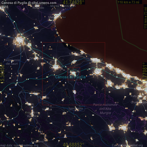
Analysis of Canosa di Puglia night lights 2016
Square area 10x10 km:
 1.79%
1.79%90-99
4.06%80-89
1.3%70-79
0.65%60-69
3.08%50-59
3.41%40-49
1.3%30-39
0.49%20-29
1.3%10-19
14.61%0-9
68.02%Square area 50x50 km:
1.25%90-99
1.8%80-89
0.92%70-79
0.84%60-69
0.95%50-59
0.93%40-49
0.74%30-39
1.09%20-29
3.04%10-19
7.41%0-9
81.02%Clear (daylight) street map image can be seen on geolist.org.
Map coordinates:
41° 44' 46.6" North, 15° 21' 52.4" East
41° 13' 10.3" North, 16° 4' 3.6" East
40° 41' 18.7" North, 16° 46' 14.9" East
Some cities around Canosa di Puglia sort by population:
• Andria
19.3 km =12 mi,  86°
86°
• Barletta
20.8 km =12.9 mi,  59°
59°
• Cerignola
15.3 km =9.5 mi,  289°
289°
• Trinitapoli
15.3 km =9.5 mi,  6°
6°
• San Ferdinando di Puglia
9.2 km =5.7 mi,  1°
1°
• Margherita di Savoia
18.4 km =11.4 mi,  22°
22°
• Minervino Murge
15.2 km =9.4 mi,  176°
176°
• Stornara
26 km =16.2 mi, 286°
3180792 (p: 30,046)
Sources (retrieved 2019-11-25):
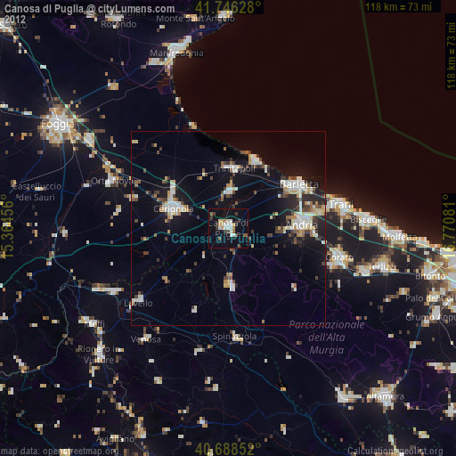
» Earth at Night: Flat Maps 2012, 2016