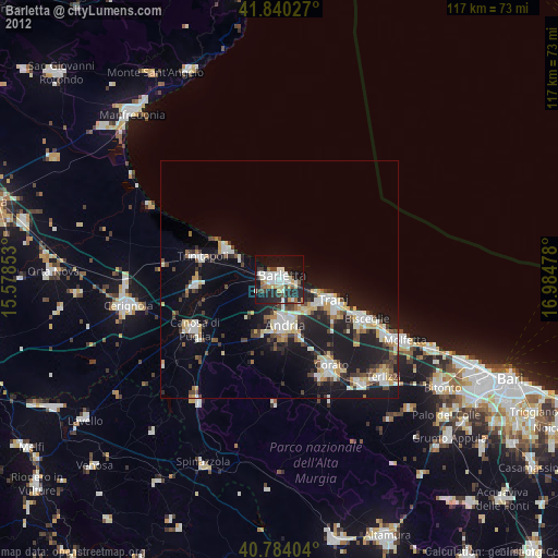
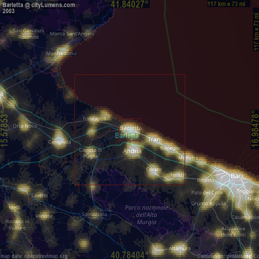
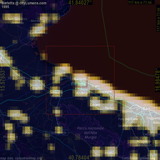
Barletta night lights from space
Night Light of Barletta (Apulia) from space (Italy) Src. Average luminocity for 10x10km area is 36.4031% and for 50x50km: 12.6582%.
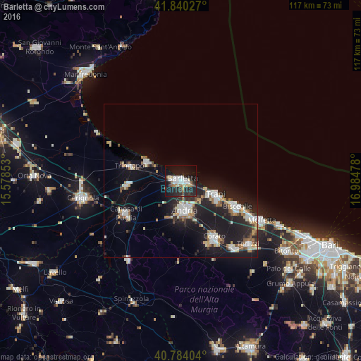
Analysis of Barletta night lights 2016
Square area 10x10 km:
 8.33%
8.33%90-99
7.48%80-89
3.57%70-79
1.7%60-69
4.08%50-59
2.38%40-49
2.04%30-39
2.38%20-29
21.6%10-19
35.37%0-9
11.05%Square area 50x50 km:
2.01%90-99
2.47%80-89
1.21%70-79
0.99%60-69
1.48%50-59
1.17%40-49
0.93%30-39
1.29%20-29
5.1%10-19
12.99%0-9
70.35%Clear (daylight) street map image can be seen on geolist.org.
Map coordinates:
41° 50' 25" North, 15° 34' 42.7" East
41° 18' 51.4" North, 16° 16' 53.9" East
40° 47' 2.5" North, 16° 59' 5.2" East
Some cities around Barletta sort by population:
• Andria
9.3 km =5.8 mi,  171°
171°
• Trani
11.5 km =7.1 mi,  110°
110°
• Bisceglie
20 km =12.4 mi, 113°
• Corato
21.1 km =13.1 mi,  149°
149°
• Canosa di Puglia
20.8 km =12.9 mi,  239°
239°
• Trinitapoli
16.7 km =10.4 mi,  286°
286°
• San Ferdinando di Puglia
17.7 km =11 mi,  265°
265°
• Margherita di Savoia
12.5 km =7.8 mi,  300°
300°
3182340 (p: 93,279)
Sources (retrieved 2019-11-25):
» NASA, Earths city lights 1995
» NASA city lights 2003
» Earth at Night: Flat Maps 2012, 2016