Trinitapoli night lights from space
Night Light of Trinitapoli (Apulia) from space (Italy) Src. Average luminocity for 10x10km area is 18.2177% and for 50x50km: 9.1917%.
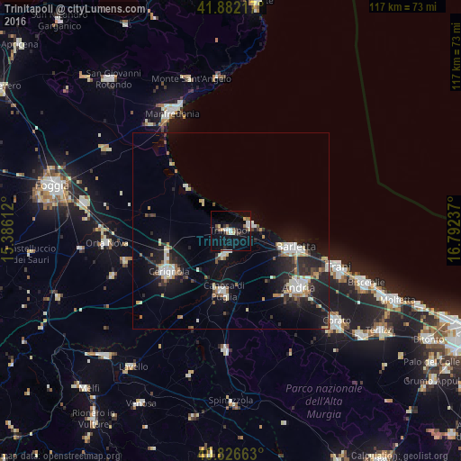
Analysis of Trinitapoli night lights 2016
Square area 10x10 km:
 2.21%
2.21%90-99
2.55%80-89
1.7%70-79
1.36%60-69
1.36%50-59
3.4%40-49
1.7%30-39
2.04%20-29
2.72%10-19
24.15%0-9
56.8%Square area 50x50 km:
1.25%90-99
1.71%80-89
0.91%70-79
0.74%60-69
0.95%50-59
0.87%40-49
0.78%30-39
1.18%20-29
3.12%10-19
8.52%0-9
79.97%Clear (daylight) street map image can be seen on geolist.org.
Map coordinates:
41° 52' 55.8" North, 15° 23' 10" East
41° 21' 23.5" North, 16° 5' 21.3" East
40° 49' 35.9" North, 16° 47' 32.5" East
Some cities around Trinitapoli sort by population:
• Andria
22.3 km =13.9 mi,  128°
128°
• Barletta
16.7 km =10.4 mi,  106°
106°
• Cerignola
19.1 km =11.9 mi,  237°
237°
• Trani
28.2 km =17.5 mi, 108°
• Canosa di Puglia
15.3 km =9.5 mi,  186°
186°
• San Ferdinando di Puglia
6.2 km =3.9 mi, 194°
• Margherita di Savoia
5.6 km =3.5 mi,  72°
72°
• Stornara
27.8 km =17.3 mi,  253°
253°
3165166 (p: 13,885)
Sources (retrieved 2019-11-25):
» Earth at Night: Flat Maps 2012, 2016