Andria night lights from space
Night Light of Andria (Apulia) from space (Italy) Src. Average luminocity for 10x10km area is 47.3555% and for 50x50km: 13.4099%.
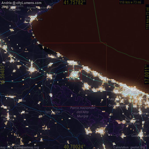
Analysis of Andria night lights 2016
Square area 10x10 km:
 8.12%
8.12%90-99
11.36%80-89
4.71%70-79
4.06%60-69
6.49%50-59
2.11%40-49
5.36%30-39
11.69%20-29
27.11%10-19
18.34%0-9
0.65%Square area 50x50 km:
2.11%90-99
2.63%80-89
1.29%70-79
1%60-69
1.51%50-59
1.26%40-49
0.98%30-39
1.39%20-29
5.3%10-19
13.73%0-9
68.8%Clear (daylight) street map image can be seen on geolist.org.
Map coordinates:
41° 45' 28.2" North, 15° 35' 41.5" East
41° 13' 52.2" North, 16° 17' 52.7" East
40° 42' 0.9" North, 17° 0' 4" East
Some cities around Andria sort by population:
• Barletta
9.3 km =5.8 mi,  351°
351°
• Trani
10.7 km =6.6 mi,  61°
61°
• Bisceglie
17 km =10.6 mi,  85°
85°
• Corato
13 km =8.1 mi,  132°
132°
• Canosa di Puglia
19.3 km =12 mi,  266°
266°
• Ruvo di Puglia
20.1 km =12.5 mi, 129°
• San Ferdinando di Puglia
20.6 km =12.8 mi,  292°
292°
• Margherita di Savoia
19.8 km =12.3 mi,  322°
322°
3183072 (p: 98,342)
Sources (retrieved 2019-11-25):
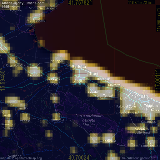
» NASA, Earths city lights 1995
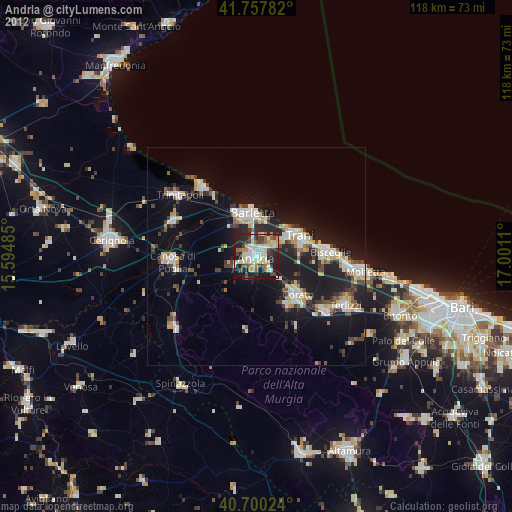
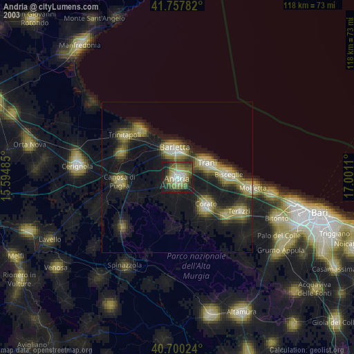
» NASA city lights 2003
» Earth at Night: Flat Maps 2012, 2016