Cairo Montenotte night lights from space
Night Light of Cairo Montenotte (Liguria) from space (Italy) Src. Average luminocity for 10x10km area is 18.2238% and for 50x50km: 6.6046%.
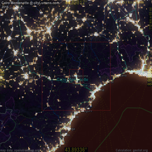
Analysis of Cairo Montenotte night lights 2016
Square area 10x10 km:
 2.38%
2.38%90-99
3.33%80-89
1.43%70-79
1.11%60-69
2.38%50-59
2.38%40-49
2.06%30-39
3.02%20-29
1.59%10-19
19.52%0-9
60.79%Square area 50x50 km:
0.63%90-99
1.03%80-89
0.36%70-79
0.42%60-69
0.72%50-59
1.13%40-49
1.33%30-39
1.25%20-29
1.68%10-19
6.07%0-9
85.38%Clear (daylight) street map image can be seen on geolist.org.
Map coordinates:
44° 53' 53.2" North, 7° 34' 28.7" East
44° 23' 52.4" North, 8° 16' 39.9" East
43° 53' 36.1" North, 8° 58' 51.2" East
Some cities around Cairo Montenotte sort by population:
• Savona
18.7 km =11.6 mi,  121°
121°
• Varazze
25.6 km =15.9 mi,  98°
98°
• Albisola Superiore
19.6 km =12.2 mi,  109°
109°
• Finale Ligure
25.9 km =16.1 mi,  168°
168°
• Vado Ligure
18.9 km =11.7 mi,  139°
139°
• Carcare
4.9 km =3 mi, 168°
• Albisola Marina
19.9 km =12.4 mi, 112°
• Vado Centro
18.9 km =11.7 mi, 139°
3181259 (p: 8,925)
Sources (retrieved 2019-11-25):
» Earth at Night: Flat Maps 2012, 2016