Brembate di Sopra night lights from space
Night Light of Brembate di Sopra (Lombardy) from space (Italy) Src. Average luminocity for 10x10km area is 77.2212% and for 50x50km: 52.7555%.
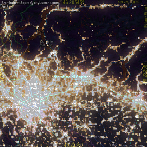
Analysis of Brembate di Sopra night lights 2016
Square area 10x10 km:
 23.94%
90-99
24.24%80-89
6.82%70-79
10.45%60-69
7.58%50-59
8.79%40-49
7.42%30-39
5.61%20-29
5.15%10-19
0%0-9
0%Square area 50x50 km:
13.35%90-99
13.16%80-89
5.13%70-79
6.72%60-69
7.46%50-59
6.57%40-49
6.27%30-39
7.15%20-29
7.7%10-19
8.67%0-9
17.83%Clear (daylight) street map image can be seen on geolist.org.
Map coordinates:
46° 12' 19.6" North, 8° 52' 34.8" East
45° 43' 0" North, 9° 34' 46" East
45° 13' 25" North, 10° 16' 57.3" East
Some cities around Brembate di Sopra sort by population:
• Ponte San Pietro
1.5 km =0.9 mi,  144°
144°
• Sorisole
4.8 km =3 mi,  69°
69°
• Curno
3.8 km =2.4 mi, 143°
• Mozzo
3 km =1.9 mi,  131°
131°
• Bonate Sopra
4.2 km =2.6 mi,  201°
201°
• Villa d'Almè
4.6 km =2.9 mi,  39°
39°
• Almenno San Salvatore
3.9 km =2.4 mi,  20°
20°
• Almè
3.7 km =2.3 mi,  48°
48°
6535775 (p: 7,627)
Sources (retrieved 2019-11-25):
» Earth at Night: Flat Maps 2012, 2016