Bergamo night lights from space
Night Light of Bergamo (Lombardy) from space (Italy) Src. Average luminocity for 10x10km area is 90.4455% and for 50x50km: 50.5471%.
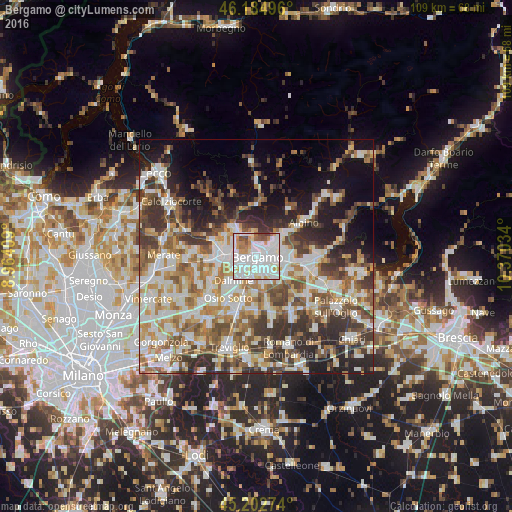

Analysis of Bergamo night lights 2016
Square area 10x10 km:
 42.27%
90-99
31.97%80-89
4.55%70-79
8.48%60-69
4.39%50-59
4.09%40-49
2.88%30-39
1.36%20-29
0%10-19
0%0-9
0%Square area 50x50 km:
11.05%90-99
11.81%80-89
4.94%70-79
6.01%60-69
7.49%50-59
7.58%40-49
7.2%30-39
8.57%20-29
8.99%10-19
10.85%0-9
15.51%Clear (daylight) street map image can be seen on geolist.org.
Map coordinates:
46° 11' 5.9" North, 8° 57' 50.7" East
45° 41' 45.6" North, 9° 40' 2" East
45° 12' 9.9" North, 10° 22' 13.2" East
Some cities around Bergamo sort by population:
• Seriate
4.6 km =2.9 mi,  104°
104°
• Sorisole
4.6 km =2.9 mi,  329°
329°
• Torre Boldone
3.9 km =2.4 mi,  53°
53°
• Curno
4.6 km =2.9 mi,  259°
259°
• Mozzo
4.6 km =2.9 mi,  273°
273°
• Azzano San Paolo
4.3 km =2.7 mi,  173°
173°
• Ponteranica
4.2 km =2.6 mi,  343°
343°
• Gorle
3.7 km =2.3 mi,  80°
80°
3182164 (p: 114,162)
Sources (retrieved 2019-11-25):
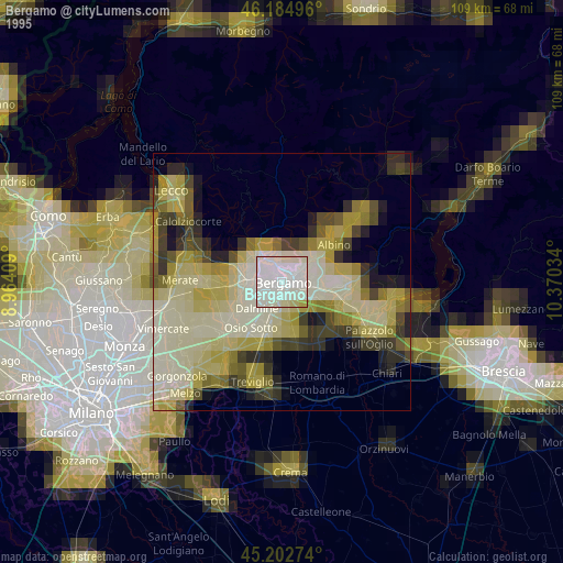
» NASA, Earths city lights 1995
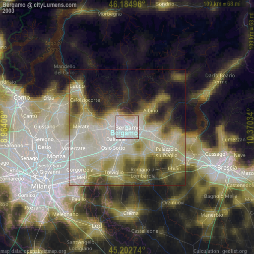
» NASA city lights 2003
» Earth at Night: Flat Maps 2012, 2016