Seriate night lights from space
Night Light of Seriate (Lombardy) from space (Italy) Src. Average luminocity for 10x10km area is 86.8818% and for 50x50km: 48.2537%.
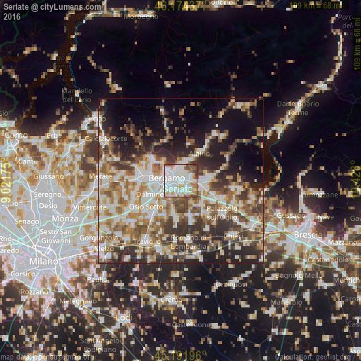
Analysis of Seriate night lights 2016
Square area 10x10 km:
 38.33%
90-99
27.12%80-89
6.21%70-79
6.97%60-69
7.88%50-59
6.21%40-49
5.91%30-39
1.36%20-29
0%10-19
0%0-9
0%Square area 50x50 km:
9.83%90-99
10.78%80-89
4.76%70-79
5.64%60-69
7.13%50-59
7.87%40-49
7.3%30-39
8.08%20-29
10.37%10-19
11.79%0-9
16.45%Clear (daylight) street map image can be seen on geolist.org.
Map coordinates:
46° 10' 27.7" North, 9° 1' 18.3" East
45° 41' 7.2" North, 9° 43' 29.5" East
45° 11' 31.1" North, 10° 25' 40.8" East
Some cities around Seriate sort by population:
• Torre Boldone
3.8 km =2.4 mi,  339°
339°
• Albano Sant'Alessandro
3.2 km =2 mi,  85°
85°
• Gorle
2 km =1.2 mi,  334°
334°
• Villa di Serio
4.2 km =2.6 mi,  10°
10°
• Scanzo-Rosciate
2.9 km =1.8 mi,  15°
15°
• Grassobbio
3.2 km =2 mi,  178°
178°
• Pedrengo
1.4 km =0.9 mi,  33°
33°
• Brusaporto
3.2 km =2 mi,  119°
119°
3166706 (p: 23,552)
Sources (retrieved 2019-11-25):
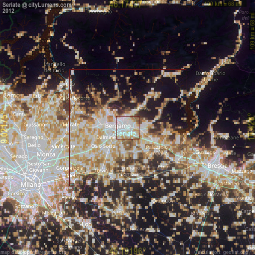
» Earth at Night: Flat Maps 2012, 2016