Adro night lights from space
Night Light of Adro (Lombardy) from space (Italy) Src. Average luminocity for 10x10km area is 66.0197% and for 50x50km: 43.8893%.
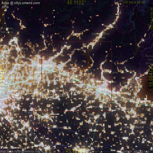
Analysis of Adro night lights 2016
Square area 10x10 km:
 10.76%
90-99
13.79%80-89
8.94%70-79
8.18%60-69
9.7%50-59
20.3%40-49
13.18%30-39
13.79%20-29
1.36%10-19
0%0-9
0%Square area 50x50 km:
8.69%90-99
9.41%80-89
3.81%70-79
4%60-69
5.85%50-59
7%40-49
6.75%30-39
8.32%20-29
13.49%10-19
17.45%0-9
15.24%Clear (daylight) street map image can be seen on geolist.org.
Map coordinates:
46° 6' 36.7" North, 9° 15' 30.5" East
45° 37' 14.1" North, 9° 57' 41.7" East
45° 7' 36" North, 10° 39' 53" East
Some cities around Adro sort by population:
• Palazzolo sull'Oglio
6.4 km =4 mi,  245°
245°
• Castelli Calepio
6 km =3.7 mi,  262°
262°
• Capriolo
2.7 km =1.7 mi,  301°
301°
• Coccaglio
6.3 km =3.9 mi,  172°
172°
• Villongo
5.9 km =3.7 mi,  336°
336°
• Cologne
4.9 km =3 mi,  198°
198°
• Corte Franca
2.3 km =1.4 mi,  63°
63°
• Sarnico
5.6 km =3.5 mi,  359°
359°
3183461 (p: 5,535)
Sources (retrieved 2019-11-25):
» Earth at Night: Flat Maps 2012, 2016