Acireale night lights from space
Night Light of Acireale (Sicily) from space (Italy) Src. Average luminocity for 10x10km area is 57.9762% and for 50x50km: 22.7508%.
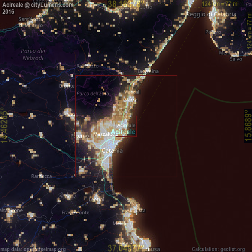

Analysis of Acireale night lights 2016
Square area 10x10 km:
 13.27%
90-99
14.29%80-89
7.65%70-79
12.93%60-69
10.88%50-59
1.02%40-49
1.7%30-39
2.55%20-29
11.39%10-19
15.48%0-9
8.84%Square area 50x50 km:
4.04%90-99
4.35%80-89
3.46%70-79
3.64%60-69
3.86%50-59
2.09%40-49
2.06%30-39
2.71%20-29
5.99%10-19
9.33%0-9
58.47%Clear (daylight) street map image can be seen on geolist.org.
Map coordinates:
38° 9' 49.6" North, 14° 27' 45.5" East
37° 36' 31.9" North, 15° 9' 56.8" East
37° 2' 59.2" North, 15° 52' 8" East
Some cities around Acireale sort by population:
• Aci Catena
2.1 km =1.3 mi,  261°
261°
• San Giovanni la Punta
7.3 km =4.5 mi,  240°
240°
• Aci Castello
6.2 km =3.9 mi,  196°
196°
• Tremestieri Etneo
9.1 km =5.7 mi, 237°
• Aci Sant'Antonio
3.8 km =2.4 mi, 263°
• Trecastagni
7.8 km =4.8 mi,  275°
275°
• Viagrande
6 km =3.7 mi,  271°
271°
• San Gregorio di Catania
6.6 km =4.1 mi,  226°
226°
2525790 (p: 49,477)
Sources (retrieved 2019-11-25):
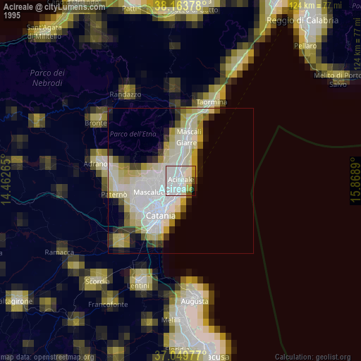
» NASA, Earths city lights 1995
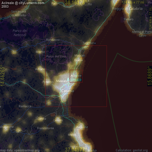
» NASA city lights 2003
» Earth at Night: Flat Maps 2012, 2016