Aci Catena night lights from space
Night Light of Aci Catena (Sicily) from space (Italy) Src. Average luminocity for 10x10km area is 74.2415% and for 50x50km: 23.4015%.
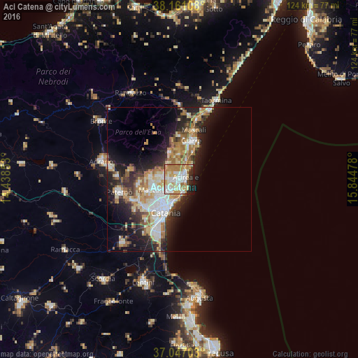
Analysis of Aci Catena night lights 2016
Square area 10x10 km:
 17.35%
90-99
21.09%80-89
12.24%70-79
15.99%60-69
13.27%50-59
1.36%40-49
1.87%30-39
2.55%20-29
10.37%10-19
3.91%0-9
0%Square area 50x50 km:
4.11%90-99
4.41%80-89
3.55%70-79
3.75%60-69
3.92%50-59
2.11%40-49
2.1%30-39
2.8%20-29
6.25%10-19
10.2%0-9
56.8%Clear (daylight) street map image can be seen on geolist.org.
Map coordinates:
38° 9' 39.9" North, 14° 26' 18.7" East
37° 36' 22.1" North, 15° 8' 29.9" East
37° 2' 49.3" North, 15° 50' 41.2" East
Some cities around Aci Catena sort by population:
• Acireale
2.1 km =1.3 mi,  81°
81°
• San Giovanni la Punta
5.3 km =3.3 mi,  232°
232°
• Tremestieri Etneo
7.2 km =4.5 mi, 230°
• Aci Sant'Antonio
1.7 km =1.1 mi,  265°
265°
• Trecastagni
5.7 km =3.5 mi,  280°
280°
• Sant'Agata Li Battiati
7.7 km =4.8 mi, 225°
• Viagrande
3.9 km =2.4 mi, 276°
• San Gregorio di Catania
5.1 km =3.2 mi,  212°
212°
2525791 (p: 24,663)
Sources (retrieved 2019-11-25):
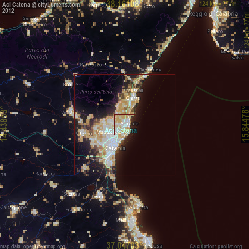
» Earth at Night: Flat Maps 2012, 2016