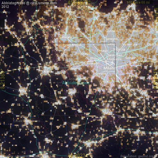
Abbiategrasso night lights from space
Night Light of Abbiategrasso (Lombardy) from space (Italy) Src. Average luminocity for 10x10km area is 44.1222% and for 50x50km: 50.1035%.
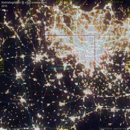
Analysis of Abbiategrasso night lights 2016
Square area 10x10 km:
 6.03%
6.03%90-99
8.57%80-89
5.08%70-79
5.24%60-69
5.24%50-59
1.75%40-49
6.51%30-39
14.29%20-29
24.92%10-19
22.38%0-9
0%Square area 50x50 km:
17.5%90-99
11.64%80-89
3.99%70-79
4.59%60-69
4.94%50-59
3.62%40-49
4.18%30-39
4.84%20-29
12.23%10-19
15.09%0-9
17.37%Clear (daylight) street map image can be seen on geolist.org.
Map coordinates:
45° 53' 23.2" North, 8° 12' 49.2" East
45° 23' 53.6" North, 8° 55' 0.4" East
44° 54' 8.4" North, 9° 37' 11.7" East
Some cities around Abbiategrasso sort by population:
• Vigevano
10.6 km =6.6 mi,  207°
207°
• Magenta
7.8 km =4.8 mi,  341°
341°
• Corbetta
7.7 km =4.8 mi,  1°
1°
• Vittuone
10.3 km =6.4 mi,  15°
15°
• Gaggiano
9.2 km =5.7 mi,  85°
85°
• Cassolnovo
9.1 km =5.7 mi,  243°
243°
• Cerano
10.5 km =6.5 mi,  276°
276°
• Rosate
9.5 km =5.9 mi,  124°
124°
3183573 (p: 30,659)
Sources (retrieved 2019-11-25):
» Earth at Night: Flat Maps 2012, 2016