Rosate night lights from space
Night Light of Rosate (Lombardy) from space (Italy) Src. Average luminocity for 10x10km area is 37.7746% and for 50x50km: 48.6841%.
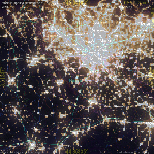
Analysis of Rosate night lights 2016
Square area 10x10 km:
 2.54%
2.54%90-99
5.08%80-89
5.56%70-79
5.87%60-69
5.08%50-59
2.7%40-49
3.97%30-39
5.87%20-29
38.73%10-19
23.17%0-9
1.43%Square area 50x50 km:
16.69%90-99
10.71%80-89
4.2%70-79
3.99%60-69
4.56%50-59
3.74%40-49
4.47%30-39
5.18%20-29
11.89%10-19
19.5%0-9
15.05%Clear (daylight) street map image can be seen on geolist.org.
Map coordinates:
45° 50' 29.9" North, 8° 18' 48.5" East
45° 20' 58.7" North, 9° 0' 59.7" East
44° 51' 12.1" North, 9° 43' 11" East
Some cities around Rosate sort by population:
• Abbiategrasso
9.5 km =5.9 mi,  304°
304°
• Romano Banco
10.8 km =6.7 mi,  40°
40°
• Trezzano sul Naviglio
8.8 km =5.5 mi,  24°
24°
• Casorate Primo
4.3 km =2.7 mi,  179°
179°
• Motta Visconti
7.1 km =4.4 mi,  195°
195°
• Lacchiarella
9.9 km =6.2 mi,  107°
107°
• Binasco
6.4 km =4 mi, 108°
• Gaggiano
6.3 km =3.9 mi,  13°
13°
3168954 (p: 5,158)
Sources (retrieved 2019-11-25):
» Earth at Night: Flat Maps 2012, 2016