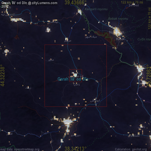
Qarah Ẕīā’ od Dīn night lights from space
Night Light of Qarah Ẕīā’ od Dīn (West Azerbaijan) from space (Iran) Src. Average luminocity for 10x10km area is 18.8588% and for 50x50km: 1.6804%.
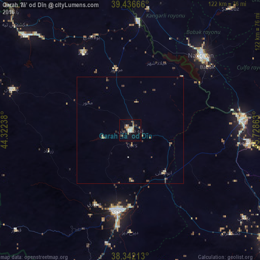
Analysis of Qarah Ẕīā’ od Dīn night lights 2016
Square area 10x10 km:
 2.04%
2.04%90-99
4.25%80-89
1.02%70-79
2.21%60-69
2.72%50-59
3.06%40-49
2.55%30-39
1.19%20-29
1.53%10-19
11.39%0-9
68.03%Square area 50x50 km:
0.08%90-99
0.26%80-89
0.15%70-79
0.22%60-69
0.22%50-59
0.35%40-49
0.33%30-39
0.44%20-29
0.28%10-19
0.55%0-9
97.13%Clear (daylight) street map image can be seen on geolist.org.
Map coordinates:
39° 26' 12" North, 44° 19' 20.6" East
38° 53' 29.4" North, 45° 1' 31.8" East
38° 20' 31.7" North, 45° 43' 43.1" East
Some cities around Qarah Ẕīā’ od Dīn sort by population:
• Khowy
38.5 km =23.9 mi,  189°
189°
• Marand
82.7 km =51.4 mi,  128°
128°
• Salmās
80.4 km =50 mi,  196°
196°
• Nakhchivan, AZ
48.6 km =30.2 mi,  43°
43°
• Culfa, AZ
52.7 km =32.7 mi,  82°
82°
• Yaycı, AZ
61.4 km =38.2 mi, 84°
• Cahri, AZ
60.9 km =37.8 mi,  33°
33°
• Sharur City, AZ
73.7 km =45.8 mi,  356°
356°
119730 (p: 31,947)
Sources (retrieved 2019-11-25):
» Earth at Night: Flat Maps 2012, 2016