Waghāi night lights from space
Night Light of Waghāi (Gujarat) from space (India) Src. Average luminocity for 10x10km area is 2.1932% and for 50x50km: 0.8575%.
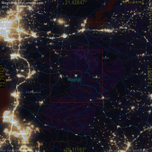
Analysis of Waghāi night lights 2016
Square area 10x10 km:
 0%
0%90-99
0%80-89
0.76%70-79
0%60-69
0.76%50-59
1.14%40-49
0.38%30-39
0%20-29
0%10-19
0%0-9
96.97%Square area 50x50 km:
0%90-99
0%80-89
0.13%70-79
0.1%60-69
0.19%50-59
0.22%40-49
0.27%30-39
0.2%20-29
0.3%10-19
0.3%0-9
98.29%Clear (daylight) street map image can be seen on geolist.org.
Map coordinates:
21° 25' 35.3" North, 72° 47' 51.4" East
20° 46' 13.7" North, 73° 30' 2.7" East
20° 6' 41.9" North, 74° 12' 13.9" East
Some cities around Waghāi sort by population:
• Vyāra
39.4 km =24.5 mi,  343°
343°
• Songadh
44.9 km =27.9 mi,  8°
8°
• Dharampur
42.8 km =26.6 mi,  232°
232°
• Gandevi
52.5 km =32.6 mi,  275°
275°
• Ahwa
19.3 km =12 mi,  94°
94°
• Vānsada
14.3 km =8.9 mi,  264°
264°
• Chikhli
45.6 km =28.3 mi,  268°
268°
• Surgāna
27.4 km =17 mi,  148°
148°
1253024 (p: 6,462)
Sources (retrieved 2019-11-25):
» Earth at Night: Flat Maps 2012, 2016