Vadamadurai night lights from space
Night Light of Vadamadurai (Tamil Nadu) from space (India) Src. Average luminocity for 10x10km area is 4.2004% and for 50x50km: 5.6734%.
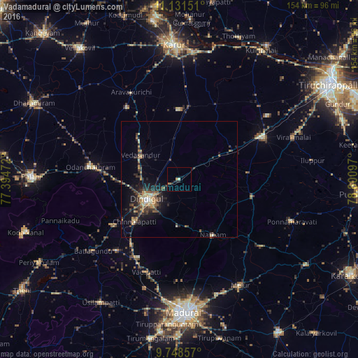
Analysis of Vadamadurai night lights 2016
Square area 10x10 km:
 0%
0%90-99
0.62%80-89
0.21%70-79
0.41%60-69
2.07%50-59
0%40-49
0%30-39
0.83%20-29
2.48%10-19
1.03%0-9
92.36%Square area 50x50 km:
0.09%90-99
0.49%80-89
0.67%70-79
1.03%60-69
0.86%50-59
0.63%40-49
1.18%30-39
1.77%20-29
1.97%10-19
3.82%0-9
87.49%Clear (daylight) street map image can be seen on geolist.org.
Map coordinates:
11° 7' 53.4" North, 77° 23' 41" East
10° 26' 26.9" North, 78° 5' 52.2" East
9° 44' 54.9" North, 78° 48' 3.5" East
Some cities around Vadamadurai sort by population:
• Dindigul
15.1 km =9.4 mi,  238°
238°
• Manapparai
40.4 km =25.1 mi,  62°
62°
• Nattam
27.7 km =17.2 mi,  148°
148°
• Nilakottai
40.9 km =25.4 mi,  221°
221°
• Pallappatti
39.2 km =24.4 mi,  322°
322°
• V.S.K.Valasai (Dindigul-Dist.)
15.1 km =9.4 mi,  157°
157°
• Vedasandūr
19 km =11.8 mi,  301°
301°
• Pālamedu
37.4 km =23.2 mi,  177°
177°
1253595 (p: 15,886)
Sources (retrieved 2019-11-25):
» Earth at Night: Flat Maps 2012, 2016