Uniāra night lights from space
Night Light of Uniāra (Rajasthan) from space (India) Src. Average luminocity for 10x10km area is 0% and for 50x50km: 1.6967%.
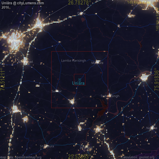
Analysis of Uniāra night lights 2016
Square area 10x10 km:
 0%
0%90-99
0%80-89
0%70-79
0%60-69
0%50-59
0%40-49
0%30-39
0%20-29
0%10-19
0%0-9
100%Square area 50x50 km:
0.16%90-99
0.42%80-89
0.2%70-79
0.09%60-69
0.27%50-59
0.16%40-49
0.14%30-39
0.15%20-29
0.23%10-19
0.62%0-9
97.57%Clear (daylight) street map image can be seen on geolist.org.
Map coordinates:
26° 46' 58" North, 74° 30' 43.6" East
26° 9' 12.1" North, 75° 12' 54.8" East
25° 31' 13.9" North, 75° 55' 6.1" East
Some cities around Uniāra sort by population:
• Tonk
57.2 km =35.5 mi,  88°
88°
• Nasīrābād
50.9 km =31.6 mi,  289°
289°
• Kekri
21.3 km =13.2 mi,  197°
197°
• Mālpura
20.8 km =12.9 mi,  45°
45°
• Todaraisingh
30.3 km =18.8 mi,  118°
118°
• Deoli
47 km =29.2 mi,  159°
159°
• Jahāzpur
59.6 km =37 mi,  174°
174°
• Sarwār
22.7 km =14.1 mi,  243°
243°
1253751 (p: 11,441)
Sources (retrieved 2019-11-25):
» Earth at Night: Flat Maps 2012, 2016